Wednesday, December 29, 2010

WISE Sees an Explosion of Infrared Light


NASA - A circular rainbow appears like a halo around an exploded star in this new view of the IC 443 nebula from NASA's Wide-field Infrared Survey Explorer, or WISE.

When massive stars die, they explode in tremendous blasts, called supernovae, which send out shock waves. The shock waves sweep up and heat surrounding gas and dust, creating supernova remnants like the one pictured here. The supernova in IC 443 happened somewhere between 5,000 and 10,000 years ago.

In this WISE image, infrared light has been color-coded to reveal what our eyes cannot see. The colors differ primarily because materials surrounding the supernova remnant vary in density. When the shock waves hit these materials, different gases were triggered to release a mix of infrared wavelengths.

The supernova remnant's northeastern shell, seen here as the violet-colored semi-circle at top left, is composed of sheet-like filaments that are emitting light from iron, neon, silicon and oxygen gas atoms and dust particles heated by a fast shock wave traveling at about 100 kilometers per second, or 223,700 mph.

The smaller southern shell, seen in bright bluish colors, is constructed of clumps and knots primarily emitting light from hydrogen gas and dust heated by a slower shock wave traveling at about 30 kilometers per second, or 67,100 miles per hour. In the case of the southern shell, the shock wave is interacting with a nearby dense cloud. This cloud can be seen in the image as the greenish dust cutting across IC 443 from the northwest to southeast.

Thursday, December 23, 2010

Dreaming of a Blue Sunset


A new Mars movie clip gives us a rover's-eye view of a bluish Martian sunset, while another clip shows the silhouette of the moon Phobos passing in front of the sun.

America's Mars Exploration Rover Opportunity, carefully guided by researchers with an artistic sense, has recorded images used in the simulated movies.

These holiday treats from the rover's panoramic camera, or Pancam, offer travel fans a view akin to standing on Mars and watching the sky.

"These visualizations of an alien sunset show what it must have looked like for Opportunity, in a way we rarely get to see, with motion," said rover science team member Mark Lemmon of Texas A&M University, College Station. Dust particles make the Martian sky appear reddish and create a bluish glow around the sun.

Lemmon worked with Pancam Lead Scientist Jim Bell, of Cornell University, Ithaca, N.Y., to plot the shots and make the moving-picture simulation from images taken several seconds apart in both sequences.

The sunset movie, combining exposures taken Nov. 4 and Nov. 5, 2010, through different camera filters, accelerates about 17 minutes of sunset into a 30-second simulation. One of the filters is specifically used to look at the sun. Two other filters used for these shots provide color information. The rover team has taken Pancam images of sunsets on several previous occasions, gaining scientifically valuable information about the variability of dust in the lower atmosphere. The new clip is the longest sunset movie from Mars ever produced, taking advantage of adequate solar energy currently available to Opportunity.

Wednesday, December 22, 2010

Apollo 8: Christmas at the Moon

Christmas Eve, 1968. As one of the most turbulent, tragic years in American history drew to a close, millions around the world were watching and listening as the Apollo 8 astronauts -- Frank Borman, Jim Lovell and Bill Anders -- became the first humans to orbit another world.

As their command module floated above the lunar surface, the astronauts beamed back images of the moon and Earth and took turns reading from the book of Genesis, closing with a wish for everyone "on the good Earth."


Monday, December 20, 2010

NASA's LRO Creating Unprecedented Topographic Map of Moon

NASA's Lunar Reconnaissance Orbiter is allowing researchers to create the most precise and complete map to date of the moon's complex, heavily cratered landscape.

"This dataset is being used to make digital elevation and terrain maps that will be a fundamental reference for future scientific and human exploration missions to the moon," said Dr. Gregory Neumann of NASA's Goddard Space Flight Center in Greenbelt, Md. "After about one year taking data, we already have nearly 3 billion data points from the Lunar Orbiter Laser Altimeter on board the LRO spacecraft, with near-uniform longitudinal coverage. We expect to continue to make measurements at this rate through the next two years of the science phase of the mission and beyond. Near the poles, we expect to provide near-GPS-like navigational capability as coverage is denser due to the spacecraft's polar orbit." Neumann will present the map at the American Geophysical Union meeting in San Francisco December 17.

Friday, December 17, 2010

NASA Spacecraft Provides Travel Tips for Mars Rover

NASA's Mars Opportunity rover is getting important tips from an orbiting spacecraft as it explores areas that might hold clues about past Martian environments.

Researchers are using a mineral-mapping instrument aboard NASA's Mars Reconnaissance Orbiter to help the rover investigate a large ancient crater called Endeavour. The orbiter's Compact Reconnaissance Imaging Spectrometer for Mars (CRISM) is providing maps of minerals at Endeavour's rim that are helping the team choose which area to explore first and where to go from there. As Mars Reconnaissance Orbiter orbits more than 241 kilometers high (150 miles), the CRISM instrument provides mapping information for mineral exposures on the surface as small as a tennis court.

"This is the first time mineral detections from orbit are being used in tactical decisions about where to drive on Mars," said Ray Arvidson of Washington University in St. Louis. Arvidson is the deputy principal investigator for the Spirit and Opportunity rovers and a co-investigator for CRISM.


Thursday, December 16, 2010

NASA's Odyssey Spacecraft Sets Exploration Record on Mars

NASA's Mars Odyssey, which launched in 2001, will break the record Wednesday for longest-serving spacecraft at the Red Planet. The probe begins its 3,340th day in Martian orbit at 5:55 p.m. PST (8:55 p.m. EST) on Wednesday to break the record set by NASA's Mars Global Surveyor, which orbited Mars from 1997 to 2006.

Odyssey's longevity enables continued science, including the monitoring of seasonal changes on Mars from year to year and the most detailed maps ever made of most of the planet. In 2002, the spacecraft detected hydrogen just below the surface throughout Mars' high-latitude regions. The deduction that the hydrogen is in frozen water prompted NASA's Phoenix Mars Lander mission, which confirmed the theory in 2008. Odyssey also carried the first experiment sent to Mars specifically to prepare for human missions, and found radiation levels around the planet from solar flares and cosmic rays are two to three times higher than around Earth.

Odyssey also has served as a communication relay, handling most of the data sent home by Phoenix and NASA's Mars Exploration Rovers Spirit and Opportunity. Odyssey became the middle link for continuous observation of Martian weather by NASA's Mars Global Surveyor and NASA's Mars Reconnaissance Orbiter.


Wednesday, December 15, 2010

Cassini Spots Potential Ice Volcano on Saturn Moon


NASA's Cassini spacecraft has found possible ice volcanoes on Saturn's moon Titan that are similar in shape to those on Earth that spew molten rock.

Topography and surface composition data have enabled scientists to make the best case yet in the outer solar system for an Earth-like volcano landform that erupts in ice. The results were presented today at the American Geophysical Union meeting in San Francisco.

"When we look at our new 3-D map of Sotra Facula on Titan, we are struck by its resemblance to volcanoes like Mt. Etna in Italy, Laki in Iceland and even some small volcanic cones and flows near my hometown of Flagstaff," said Randolph Kirk, who led the 3-D mapping work, and is a Cassini radar team member and geophysicist at the U.S. Geological Survey (USGS) Astrogeology Science Center in Flagstaff, Ariz.


Friday, December 10, 2010

Odyssey Orbiter Nears Martian Longevity Record


NASA's Mars Odyssey orbiter will have worked longer at Mars than any other spacecraft in history.

Odyssey entered orbit around Mars on Oct. 24, 2001. On Dec. 15, the 3,340th day since that arrival, it will pass the Martian career longevity record set by its predecessor, Mars Global Surveyor, which operated in orbit from Sept. 11, 1997, to Nov. 2, 2006.

Odyssey made its most famous discovery -- evidence for copious water ice just below the dry surface of Mars -- during its first few months, and it finished its radiation-safety check for future astronauts before the end of its prime mission in 2004. The bonus years of extended missions since then have enabled many accomplishments that would not have been possible otherwise.


Wednesday, December 08, 2010

NASA Mars Rover Images Honor Apollo 12

NASA's Mars Exploration Rover Opportunity has visited and photographed two craters informally named for the spacecraft that carried men to the moon 41 years ago this week.

Opportunity drove past "Yankee Clipper" crater on Nov. 4 and reached "Intrepid crater" on Nov. 9. For NASA's Apollo 12, the second mission to put humans onto the moon, the command and service module was called Yankee Clipper, piloted by Dick Gordon, and the lunar module was named Intrepid, piloted by Alan Bean and commanded by the late Pete Conrad. The Intrepid landed on the moon with Bean and Conrad on Nov. 19, 1969, while Yankee Clipper orbited overhead. Their landing came a mere four months after Apollo 11's first lunar landing.


Thursday, November 18, 2010

NASA's Mobile Mars Laboratory nearly complete for Flight

NASA's Mobile Mars Laboratory
The Sample Analysis at Mars (SAM) instrument suite has completed assembly at NASA's Goddard Space Flight Center in Greenbelt, Md., and is nearly ready for a December delivery to NASA's Jet Propulsion Laboratory (JPL), Pasadena, Calif., where it will be joined to the Curiosity rover. SAM and Curiosity are set to fly on the upcoming Mars Science Laboratory (MSL) rover mission scheduled for launch in the fall of 2011.

SAM will become an automated, mobile laboratory as it is carried across Mars by the rover when the mission arrives at the Red Planet in 2012. Together with other instruments on Curiosity, SAM will assess whether Mars ever was, or is still today, an environment able to support microbial life.

"We expect Curiosity will make amazing discoveries," said SAM Principal Investigator Dr. Paul Mahaffy of NASA Goddard, "and we are looking forward to the contributions our mobile chemistry laboratory can make to a better understanding of the history of our neighboring planet."

SAM is in flight configuration, meaning its instruments are in the condition they will be during launch and are ready to begin operations on Mars. The instrument suite (a mass spectrometer, gas chromatograph, and tunable laser spectrometer) has started final environmental testing this week, which includes vibration and thermal testing to ensure SAM can survive the launch, deep space flight, and conditions on Mars.

Once at Mars, SAM will examine the planet's habitability by exploring molecular and elemental chemistry relevant to life. SAM will analyze samples of Martian rock and soil to assess carbon chemistry through a search for organic compounds. The lab will also determine the chemical state of light elements other than carbon, and look for isotopic tracers of planetary change.

Wednesday, October 20, 2010

Pinwheel of Star Birth


NASA - Though the universe is chock full of spiral-shaped galaxies, no two look exactly the same. This face-on spiral galaxy, called NGC 3982, is striking for its rich tapestry of star birth, along with its winding arms. The arms are lined with pink star-forming regions of glowing hydrogen, newborn blue star clusters, and obscuring dust lanes that provide the raw material for future generations of stars. The bright nucleus is home to an older population of stars, which grow ever more densely packed toward the center.

NGC 3982 is located about 68 million light-years away in the constellation Ursa Major. The galaxy spans about 30,000 light-years, one-third of the size of our Milky Way galaxy. This color image is composed of exposures taken by the Hubble Space Telescope's Wide Field Planetary Camera 2 (WFPC2), the Advanced Camera for Surveys (ACS), and the Wide Field Camera 3 (WFC3). The observations were taken between March 2000 and August 2009. The rich color range comes from the fact that the galaxy was photographed invisible and near-infrared light. Also used was a filter that isolates hydrogen emission that emanates from bright star-forming regions dotting the spiral arms.

The Hubble Space Telescope is a project of international cooperation between NASA and the European Space Agency. NASA's Goddard Space Flight Center manages the telescope. The Space Telescope Science Institute (STScI) conducts Hubble science operations. STScI is operated for NASA by the Association of Universities for Research in Astronomy, Inc. in Washington, D.C.

Friday, October 08, 2010

MAVEN task to consider – “How Sun Steals Martian Atmosphere”

The Red Planet bleeds. Not blood, but its atmosphere, slowly trickling away to space. The culprit is our sun, which is using its own breath, the solar wind, and its radiation to rob Mars of its air. The crime may have condemned the planet's surface, once apparently promising for life, to a cold and sterile existence.

In the upper left of this Hubble Space Telescope image, at high northern latitudes, a large chevron-shaped area of water ice clouds mark a storm front. Along the right limb, a large cloud system has formed around the Olympus Mons volcano
Features on Mars resembling dry riverbeds, and the discovery of minerals that form in the presence of water, indicate that Mars once had a thicker atmosphere and was warm enough for liquid water to flow on the surface. However, somehow that thick atmosphere got lost in space. It appears Mars has been cold and dry for billions of years, with an atmosphere so thin, any liquid water on the surface quickly boils away while the sun's ultraviolet radiation scours the ground.

Such harsh conditions are the end of the road for known forms of life. Although it's possible that martian life went underground, where liquid water may still exist and radiation can't reach.

The lead suspect for the theft is the sun, and its favorite M.O. may be the solar wind. All planets in our solar system are constantly blasted by the solar wind, a thin stream of electrically charged gas that continuously blows from the sun's surface into space. On Earth, our planet's global magnetic field shields our atmosphere by diverting most of the solar wind around it. The solar wind’s electrically charged particles, ions and electrons, have difficulty crossing magnetic fields.

"Mars can't protect itself from the solar wind because it no longer has a shield, the planet's global magnetic field is dead," said Bruce Jakosky of the University of Colorado, Boulder. Jakosky is the Principal Investigator for NASA's MAVEN mission, which will investigate what is responsible for the loss of the martian atmosphere. NASA selected the MAVEN (Mars Atmosphere and Volatile Evolution Mission) on September 15, 2008.

Tuesday, October 05, 2010

Ping-Pong Balls to Float Crew Capsule Simulator

If ping-pong balls can float a sunken boat, they should be able to keep an uncrewed space capsule simulator from sinking.

That's what a team of summer students and engineers think at NASA’s Langley Research Center in Hampton, Va. Langley is fabricating a proposed design of an astronaut crew module simulator for uncrewed flight-testing as part of the agency's effort to build a vehicle to replace the space shuttle.

Because the crew module will not be pressurized during the test, it will not have the buoyancy of a pressurized spacecraft. This puts the simulated crew module at risk of sinking to the bottom of the Atlantic Ocean after splashdown.

Ping-Pong Ball
"At first we didn't really realize that we were going to get so far in proving that it would be possible," said Kirk, a Suffolk, Va., native attending Virginia Tech as an aerospace engineering major. "But when we thought about everything logically, it just seemed like ping-pong balls were the way to go."

She and a team of seven other students worked the project in Langley's Mechanical Systems Branch, where they were assigned for the summer.

DiNonno got the idea from a Discovery Channel program about raising a sunken boat using 27,000 ping-pong balls.

Engineer David Covington said that when DiNonno suggested the ping-pong ball idea, "I just laughed. Not a 'what are you thinking' kind of laugh, but more of a 'that's the most awesome thing I've heard in a long time' laugh. I asked him 'are you serious?' and he said 'yeah, we're authorized to do a four-week study.' So we went straight to work."

Wednesday, September 22, 2010

NASA's LRO Exposes Moon's Complex, Turbulent Youth

The moon was bombarded by two distinct populations of asteroids or comets in its youth, and its surface is more complex than previously thought, according to new results from NASA's Lunar Reconnaissance Orbiter (LRO) spacecraft featured in three papers appearing in the Sept. 17 issue of Science.

Moon
In the first paper, lead author James Head of Brown University in Providence, R.I., describes results obtained from a detailed global topographic map of the moon created using LRO's Lunar Orbiter Laser Altimeter (LOLA). "Our new LRO LOLA dataset shows that the older highland impactor population can be clearly distinguished from the younger population in the lunar 'maria' -- giant impact basins filled with solidified lava flows," says Head. "The highlands have a greater density of large craters compared to smaller ones, implying that the earlier population of impactors had a proportionally greater number of large fragments than the population that characterized later lunar history."

Meteorite impacts can radically alter the history of a planet. The moon, Mars, and Mercury all bear scars of ancient craters hundreds or even thousands of miles across. If Earth was subjected to this assault as well -- and there's no reason to assume our planet was spared -- these enormous impacts could have disrupted the initial origin of life. Large impacts that occurred later appear to have altered life's evolution. The approximately 110-mile-diameter, partially buried crater at Chicxulub, in the Yucatan Peninsula of Mexico, is from an impact about 65 million years ago that is now widely believed to have led or contributed to the demise of the dinosaurs and many other lifeforms.

Scientists trying to reconstruct the meteorite bombardment history of Earth face difficulty because impact craters are eroded by wind and water, or destroyed by the action of plate tectonics, the gradual movement and recycling of the Earth's crust. However, a rich record of craters is preserved on the moon, because it has only an extremely thin atmosphere – a vacuum better than those typically used for experiments in laboratories on Earth. The moon’s surface has no liquid water and no plate tectonics. The only source of significant erosion is other impacts.

"The moon is thus analogous to a Rosetta stone for understanding the bombardment history of the Earth," said Head. "Like the Rosetta stone, the lunar record can be used to translate the 'hieroglyphics' of the poorly preserved impact record on Earth."

Tuesday, September 07, 2010

The Moon Puts on Camo

A new geologic map of the moon's Schrödinger basin paints an instant, camouflage-colored portrait of what a mash-up the moon's surface is after eons of violent events. The geologic record at Schrödinger is still relatively fresh because the basin is only about 3.8 billion years old; this makes it the moon's second-youngest large basin (it's roughly 320 kilometers, or 200 miles, in diameter).


This detailed geologic map of Schrödinger basin, which formed when a huge object struck the moon, reveals a patchwork of lunar material, including the peak ring (inner brown ring), recent volcanic activity (red), cratering (yellow) and plains material (dark green and kelly green). Credit: NASA/Scott Mest

Schrödinger is located near the moon's south pole, a region where pockets of permanent ice are thought to exist. The map will help researchers understand lunar geologic history and identify suitable landing sites for future exploration. Scott Mest, a research scientist with the Planetary Science Institute working at NASA's Goddard Space Flight Center in Greenbelt, Md., and his colleagues created this geologic map -- the most detailed one to date -- by combining topographic data from the Lunar Orbiter Laser Altimeter, a Goddard instrument aboard the 2009 Lunar Reconnaissance Orbiter, with images and spectral data from the earlier Clementine and Lunar Prospector missions.

Schrödinger is an example of an intriguing type of basin called a peak-ring. Like the basin rim (brown outer ring), the smaller and more fragmented peak ring (brown inner ring) is a mountainous region of crust that rose up after a huge object, probably measuring 35-40 kilometers, or about 21-25 miles, smacked into the moon here. These areas of raised crust are the oldest rocks in the basin and just about the only material that wasn't melted by the heat from the object's impact. The melted material was spewed in all directions and formed the plains. Patches of plains material can have slightly different textures and albedo (indicated by dark green and kelly green), probably because they cooled at different times. Fractures (black lines) formed in the basin floor as the material cooled.

Friday, August 20, 2010

NASA's Marks 35th Anniversary of Mars Viking Mission

First photograph ever taken on the surface of the planet Mars
From the perennial Mars hoax to Ray Bradbury's The Martian Chronicles, no other body in our solar system has so captured the human imagination. Throughout history mankind has gazed into the night sky wondering what civilizations awaited those who landed on the Red Planet's surface. The novels of Burroughs and others tout the planet's allure and films have warned humanity of its dangers.

In 1965, the Mariner 4 spacecraft sent the first images of another planet to waiting scientists on Earth. Since that image, the Red Planet has revealed a world strangely familiar, yet challenging. Each time scientists feel close to understanding Mars, new discoveries send them back to the drawing board to revise existing theories.

In the 35 years since NASA launched Viking 1 on Aug. 20, 1975, the ambitious mission only whetted the scientific world and public's enthusiasm for future space exploration. In the ensuing years, NASA has launched the Phoenix Mars Lander, Mars Reconnaissance Orbiter and Mars Exploration Rovers, among others. Perhaps the most successful of these missions is Mars Exploration Rovers. Launched in June and July 2003, respectively, Spirit and Opportunity landed on Mars each for a 90-day mission that continues after more than 6 years.

For centuries, scientists wondered if Mars might be covered with vegetation -- or even inhabited by intelligent beings. Today, we know Mars to be quite different. It is a frozen desert world with now silent volcanoes and deep canyons. Polar ice caps expand and contract with the Martian seasons.

While the story began years earlier, it culminated in August and September 1975 with the launch of two large, nearly identical spacecraft from Cape Canaveral, Fl. Vikings 1 and 2, named for the fearless Nordic explorers of Earth, finally give humans a close-up look at this alien world.

Viking 1 and 2, each consisting of an orbiter and a lander, became the first space probes to obtain high resolution images of the Martian surface; characterize the structure and composition of the atmosphere and surface; and conduct on-the-spot biological tests for life on another planet.

Among the discoveries about Mars over the years, one stands out above all others: the possible presence of liquid water, either in its ancient past or preserved in the subsurface today. Water is key because almost everywhere water is found on Earth, so is life. If Mars once had liquid water, or still does today, it's compelling to ask whether any microscopic life forms could have developed on its surface.

Viking 1 arrived at Mars on June 19, 1976. On July 20, 1976, the Viking 1 lander separated from the orbiter and touched down at Chryse Planitia. Viking 2 was launched Sept. 9, 1975, and entered Mars orbit Aug. 7, 1976. The Viking 2 lander touched down at Utopia Planitia on Sept. 3, 1976.

Tuesday, August 10, 2010

Hundreds of New vision from Telescope ranging Mars


The latest set of new images from the telescopic High Resolution Imaging Science Experiment Camera on NASA's Mars Reconnaissance Orbiter offers detailed views of diverse Martian landscapes.

Features as small as desks are revealed in the 314 observations made between June 6 and July 7, 2010, now available on the camera team's site and NASA's Planetary Data System.

The camera is one of six instruments on NASA's Mars Reconnaissance Orbiter, which reached Mars in 2006. For more information about the mission, see http://mars.jpl.nasa.gov/mro/ .

Thursday, June 17, 2010

Research Suggests Water Content of Moon's Interior Underestimated

Earthrise as seen from Apollo 8.NASA - funded scientists estimate from recent research that the volume of water molecules locked inside minerals in the moon’s interior could exceed the amount of water in the Great Lakes here on Earth.

Scientists at the Carnegie Institution’s Geophysical Laboratory in Washington, along with other scientists across the nation, determined that the water was likely present very early in the moon’s formation history as hot magma started to cool and crystallize. This finding means water is native to the moon.

“For over 40 years we thought the moon was dry,” said Francis McCubbin of Carnegie and lead author of the report published in Monday's Online Early Edition of the Proceedings of the National Academy of Sciences. “In our study we looked at hydroxyl, a compound with an oxygen atom bound with hydrogen, and apatite, a water-bearing mineral in the assemblage of minerals we examined in two Apollo samples and a lunar meteorite.”

McCubbin’s team utilized tests which detect elements in the parts per billion range. Combining their measurements with models that characterize how the material crystallized as the moon cooled during formation, they found that the minimum water content ranged from 64 parts per billion to 5 parts per million. The result is at least two orders of magnitude greater than previous results from lunar samples that estimated water content of the moon to be less than 1 parts per billion.

"In this case, when we talk about water on the moon, we mean water in the structural form hydroxyl,” said Jim Green, director of the Planetary Science Division at NASA Headquarters in Washington. “This is a very minor component of the rocks that make up the lunar interior.”

The origin of the moon is now commonly believed to be the result of a Mars-sized object that impacted the Earth 4.5 billion years ago. This impact put a large amount of material into Earth’s orbit that ultimately compacted to form the moon. The lunar magma ocean that is thought to have formed at some point during the compacting process, began to cool. During this cooling, water either escaped or was preserved as hydroxyl molecules in the crystallizing minerals.

Tuesday, June 08, 2010

NASA Rover Finds Clue to Mars' Past And Environment for Life

Rocks examined by NASA's Spirit Mars Rover hold evidence of a wet, non-acidic ancient environment that may have been favorable for life. Confirming this mineral clue took four years of analysis by several scientists.

An outcrop that Spirit examined in late 2005 revealed high concentrations of carbonate, which originates in wet, near-neutral conditions, but dissolves in acid. The ancient water indicated by this find was not acidic.

NASA's rovers have found other evidence of formerly wet Martian environments. However the data for those environments indicate conditions that may have been acidic. In other cases, the conditions were definitely acidic, and therefore less favorable as habitats for life.

Laboratory tests helped confirm the carbonate identification. The findings were published online Thursday, June 3 by the journal Science.

"This is one of the most significant findings by the rovers," said Steve Squyres of Cornell University in Ithaca, N.Y. Squyres is principal investigator for the Mars twin rovers, Spirit and Opportunity, and a co-author of the new report. "A substantial carbonate deposit in a Mars outcrop tells us that conditions that could have been quite favorable for life were present at one time in that place. "


Spirit inspected rock outcrops, including one scientists called Comanche, along the rover's route from the top of Husband Hill to the vicinity of the Home Plate plateau which Spirit has studied since 2006. Magnesium iron carbonate makes up about one-fourth of the measured volume in Comanche. That is a tenfold higher concentration than any previously identified for carbonate in a Martian rock.

"We used detective work combining results from three spectrometers to lock this down," said Dick Morris, lead author of the report and a member of a rover science team at NASA's Johnson Space Center in Houston."The instruments gave us multiple, interlocking ways of confirming the magnesium iron carbonate, with a good handle on how much there is."

Massive carbonate deposits on Mars have been sought for years without much success. Numerous channels apparently carved by flows of liquid water on ancient Mars suggest the planet was formerly warmer, thanks to greenhouse warming from a thicker atmosphere than exists now. The ancient, dense Martian atmosphere was probably rich in carbon dioxide, because that gas makes up nearly all the modern, very thin atmosphere.

It is important to determine where most of the carbon dioxide went. Some theorize it departed to space. Others hypothesize that it left the atmosphere by the mixing of carbon dioxide with water under conditions that led to forming carbonate minerals. That possibility, plus finding small amounts of carbonate in meteorites that originated from Mars, led to expectations in the 1990s that carbonate would be abundant on Mars. However, mineral-mapping spectrometers on orbiters since then have found evidence of localized carbonate deposits in only one area, plus small amounts distributed globally in Martian dust.

Monday, May 24, 2010

Phoenix Mars Lander is Silent, New Image Shows Damage

Two images of the Phoenix Mars lander taken from Martian orbit in 2008 and 2010. The 2008 lander image shows two relatively blue spots on either side corresponding to the spacecraft's clean circular solar panels. In the 2010 image scientists see a dark shadow that could be the lander body and eastern solar panel, but no shadow from the western solar panel. Image credit: NASA/JPL-Caltech/University of Arizona
PASADENA, Calif. -- NASA's Phoenix Mars Lander has ended operations after repeated attempts to contact the spacecraft were unsuccessful. A new image transmitted by NASA's Mars Reconnaissance Orbiter shows signs of severe ice damage to the lander's solar panels.

"The Phoenix spacecraft succeeded in its investigations and exceeded its planned lifetime," said Fuk Li, manager of the Mars Exploration Program at NASA's Jet Propulsion Laboratory in Pasadena, Calif. "Although its work is finished, analysis of information from Phoenix's science activities will continue for some time to come."

Last week, NASA's Mars Odyssey orbiter flew over the Phoenix landing site 61 times during a final attempt to communicate with the lander. No transmission from the lander was detected. Phoenix also did not communicate during 150 flights in three earlier listening campaigns this year.

Earth-based research continues on discoveries Phoenix made during summer conditions at the far-northern site where it landed May 25, 2008. The solar-powered lander completed its three-month mission and kept working until sunlight waned two months later.

This view of one of the Mars Phoenix Lander's solar panels is a composite of multiple exposures taken by the spacecraft's Surface Stereo Imager camera. Image credit: NASA/JPL-Caltech/University Arizona/Texas A&M University
Phoenix was not designed to survive the dark, cold, icy winter. However, the slim possibility Phoenix survived could not be eliminated without listening for the lander after abundant sunshine returned.

An image of Phoenix taken this month by the High Resolution Imaging Science Experiment, or HiRISE, camera on board the Mars Reconnaissance Orbiter suggests the lander no longer casts shadows the way it did during its working lifetime.

"Before and after images are dramatically different," said Michael Mellon of the University of Colorado in Boulder, a science team member for both Phoenix and HiRISE. "The lander looks smaller, and only a portion of the difference can be explained by accumulation of dust on the lander, which makes its surfaces less distinguishable from surrounding ground."

Apparent changes in the shadows cast by the lander are consistent with predictions of how Phoenix could be damaged by harsh winter conditions. It was anticipated that the weight of a carbon-dioxide ice buildup could bend or break the lander's solar panels. Mellon calculated hundreds of pounds of ice probably coated the lander in mid-winter.

During its mission, Phoenix confirmed and examined patches of the widespread deposits of underground water ice detected by Odyssey and identified a mineral called calcium carbonate that suggested occasional presence of thawed water. The lander also found soil chemistry with significant implications for life and observed falling snow. The mission's biggest surprise was the discovery of perchlorate, an oxidizing chemical on Earth that is food for some microbes and potentially toxic for others.

"We found that the soil above the ice can act like a sponge, with perchlorate scavenging water from the atmosphere and holding on to it," said Peter Smith, Phoenix principal investigator at the University of Arizona in Tucson. "You can have a thin film layer of water capable of being a habitable environment. A micro-world at the scale of grains of soil -- that's where the action is."

The perchlorate results are shaping subsequent astrobiology research, as scientists investigate the implications of its antifreeze properties and potential use as an energy source by microbes. Discovery of the ice in the uppermost soil by Odyssey pointed the way for Phoenix. More recently, the Mars Reconnaissance Orbiter detected numerous ice deposits in middle latitudes at greater depth using radar and exposed on the surface by fresh impact craters.

"Ice-rich environments are an even bigger part of the planet than we thought," Smith said. "Somewhere in that vast region there are going to be places that are more habitable than others."

The Mars Reconnaissance Orbiter reached the planet in 2006 to begin a two-year primary science mission. Its data show Mars had diverse wet environments at many locations for differing durations during the planet's history, and climate-change cycles persist into the present era. The mission has returned more planetary data than all other Mars missions combined.

Thursday, May 20, 2010

NASA Uses 'Polka Dots' For Precision Measurements

Rob Black, senior applications engineer with Shape Fidelity Inc., of Huntsville, Ala., a contractor with the Ares I Upper Stage team, sets up for photogrammetry process.What weighs 600 pounds, is shiny-silver with black and white polka dots and shaped like an upside-down saucer? If you guessed some sort of mod, fancy looking UFO, you are close. It's a fuel tank dome being developed for NASA's next-generation launch vehicles.

But why polka dots? They are part of an engineering tool called photogrammetry, the practice of determining the geometric properties of objects from photographic images. It is a process used by engineers at NASA's Marshall Space Flight Center in Huntsville, Ala., to accurately measure most everything from hardware to the tools used to make the hardware. Analytical photogrammetry is now routinely employed in tasks as diverse as machine tool inspection, fixture checking and structural deformation monitoring.

"This is a reasonably cheap process that provides engineers with a precise, three-dimensional measuring tool," said Sandeep Shah, upper stage manufacturing and assembly subsystem manager for Ares Projects at the Marshall Center. "It's a novel application of an existing technology that allows us to capture the true geometry of parts and components as they are produced, and provides immediate feedback to our team."

So How Does It Work?
The system typically requires only two engineers, a computer, a camera, targets or dots, two scale bars -- used as points of reference because of their exact length -- and a specially designed 3-D scanner.

"That’s what makes photogrammetry such a great tool," Shah said. "It's simple, mobile, fast, cheap and extremely accurate. Though we've only used photogrammetry for a couple of years, I can't imagine future development and production of flight hardware without it."

First, black and white target dots are irregularly placed several inches apart on the test object. The irregular spacing is designed to assist the computer software in identifying each individual target. Next, the engineer takes pictures of the test article from every angle, using a standard, 10-megapixel camera. The number of photographs needed varies depending on the size and shape of the test article. The photos then are transferred to a computer, where the software identifies the targets to produce a skeleton-like outline, referred to as an optical global framework.

Finally, a three-dimensional, white-light scanner is used to scan small sections of the test article -- producing accurate surface definitions and thus a near-perfect computer-aided design, or CAD, model.

Tuesday, May 18, 2010

NASA Invites Public to Take Virtual Walk on Moon

More than 37 years after humans last walked on the moon, planetary scientists are inviting members of the public to return to the lunar surface as “virtual astronauts” to help answer important scientific questions.

No spacesuit or rocket ship is required -- all visitors need to do is go to www.moonzoo.org and be among the first to see the lunar surface in unprecedented detail. New high-resolution images, taken by NASA’s Lunar Reconnaissance Orbiter Camera (LROC), offer exciting clues to unveil or reveal the history of the moon and our solar system.

“We need Web users around the world to help us interpret these stunning new images of the lunar surface,” said Chris Lintott of Oxford University and chair of the Citizen Science Alliance. “If you only spend five minutes on the site counting craters you’ll be making a valuable contribution to science and, who knows, you might run across a Russian spacecraft.”


Scientists are particularly interested in knowing how many craters appear in a particular region of the moon in order to determine the age and depth of the lunar surface (regolith). Fresh craters left by recent impacts provide clues about the potential risks from meteor strikes on the moon and on Earth.

“We hope to address key questions about the impact bombardment history of the moon and discover sites of geological interest that have never been seen before,” said Katherine Joy of the Lunar and Planetary Institute and a Moon Zoo science team member.

NASA Lunar Science Institute (NLSI) scientists are contributing to the Moon Zoo efforts by providing science expertise. NLSI is also providing educational content and supporting outreach goals of the project.

“The NASA Lunar Science Institute is very excited to be involved with Moon Zoo and support lunar citizen science,” said David Morrison, NLSI director. “Science and public outreach are cornerstones of our Institute; Moon Zoo will contribute to the accomplishment of important science, while being a major step forward in participatory exploration.”

The Moon Zoo Web site is a citizen science project developed by the Citizen Science Alliance, a group of research organizations and museums, and builds on the team's success with Galaxy Zoo, which has involved more than 250,000 people in astronomical research.

“The Lunar Reconnaissance Orbiter Project Science Office is excited to see LRO data being used for citizen science projects,” said Rich Vondrak, LRO project scientist from NASA’s Goddard Space Flight Center, Greenbelt, Md. “The Moon Zoo project provides an opportunity for everyone to participate in analysis of images from the LRO Camera and to make a significant contribution to scientific knowledge about the moon.”

The Lunar Reconnaissance Orbiter mission is managed by NASA's Goddard Space Flight Center, Greenbelt, Md. and the LROC instruments are based out of Arizona State University in Tempe, Az. The NASA Lunar Science Institute is based out of NASA’s Ames Research Center, Moffett Field, Calif.

Thursday, May 06, 2010

HELP HELP NASA Keeping Eyes in the Sky on the Gulf Oil Spill


NASA's Terra satellite flew over the Deepwater Horizon rig's oil spill in the Gulf of Mexico on Saturday, May 1 and captured a natural-color image of the slick from space. The oil slick resulted from an accident at the Deepwater Horizon rig in the Gulf of Mexico.

The Moderate Resolution Imaging Spectroradiometer (MODIS) instrument on NASA’s Terra satellite captured a natural-color image. The oil slick appeared as a tangle of dull gray on the ocean surface, made visible to the satellite sensor by the sun’s reflection on the ocean surface. On May 1, most of the oil slick was southeast of the Mississippi Delta.

The National Oceanic and Atmospheric Administration (NOAA) is the lead agency on oil spills and uses airplane fly-over's to assess oil spill extent. NASA's Terra and Aqua satellites are also helping NOAA with satellite images of the area.

On Sunday, May 2, NOAA restricted fishing in federal waters of the Gulf of Mexico from the mouth of the Mississippi to Pensacola Bay for at least ten days. More details about the closure can be found at: http://sero.nmfs.noaa.gov/. In addition to the federal closure, Louisiana closed vulnerable fisheries in state waters -- within three miles of the coast. NOAA noted that anyone wanting to report oil on land, or for general Community and Volunteer Information, please call 1-866-448-5816. To report oiled or injured wildlife, please call 1-800-557-1401.

Text credit: Rob Gutro, NASA's Goddard Space Flight Center, Greenbelt, Md.

Wednesday, April 28, 2010

Planck Sees a Icy and Violent Orion


The big hunter in the sky is seen in a new light by Planck, a European Space Agency mission with significant NASA participation. The long-wavelength image shows most of the constellation Orion, highlighting turbid clouds of cold material, where new stars are being stirred into existence.

The Planck mission is busy surveying the whole sky at longer wavelengths of light than we can see with our eyes, ranging from infrared to even longer-wavelength microwaves. It is collecting ancient light from when the universe was very young, less than half a million years old, telling us about the birth and fate of our universe. In the process, the mission is gathering data on our Milky Way galaxy that astronomers are using to see through cold pools of gas and dust, which block visible-light views of star formation.

The new image is online at: http://www.nasa.gov/mission_pages/planck/planckorion20100426.html. It shows one such region in our Milky Way, where stars are actively bursting to life. The much-photographed Orion nebula is the bright spot to the lower center. The bright spot to the right of center is around the Horsehead Nebula, so called because at high magnifications a pillar of dust resembles a horse's head. The whole view covers a square patch of sky equivalent to 26 by 26 moons.

"Because Planck is mapping the whole sky, we can capture mosaics of huge regions of the Milky Way," said Charles Lawrence, the NASA project scientist for Planck at NASA's Jet Propulsion Laboratory in Pasadena, Calif. "We are seeing the coldest material in star-forming regions, where stars are at the very earliest stages of formation."


The giant red arc of Barnard's Loop is thought to be the blast wave from a star that blew up inside the region about two million years ago. The bubble it created is now about 300 light-years across.

The picture shows light resulting from two different types of sources. At the lowest frequencies, Planck primarily maps emission from ionized gas heated by newly formed hot stars. At higher frequencies, Planck maps the meager heat emitted by extremely cold dust. This can reveal the coldest cores in the clouds, which are approaching the final stages of collapse, before they are reborn as full-fledged stars.

Monday, April 26, 2010

NASA Conducts Winning Parachute Expansion Test


On April 14, NASA conducted a drogue parachute drop test at the U.S. Army's Yuma Proving Ground near Yuma, Ariz. The 68-foot-diameter drogue and all test hardware functioned properly and landed safely.

The design load limit test will provide engineers with a better understanding of the full structural capabilities of the drogue parachute, currently under development to return next-generation space vehicles safely to Earth.

This was the second in a series of three planned load limit tests designed to place the loads expected in flight on the parachute canopy. The next test series, called overload tests, will subject the parachute canopy to loads greater than what would typically be experienced in flight, to prove the parachute is strong enough to survive some degree of unexpected events.

Future full resolution images of the drogue parachute test will be made publicly available when they are fully processed:

http://www.nasa.gov/ares


When video from the test becomes available, it will air on NASA Television's Video File. For NASA TV downlink, schedule and streaming video information, visit:

http://www.nasa.gov/ntv


Wednesday, April 21, 2010

Lunar Polar Craters May Be Electrified

As the solar wind flows over natural obstructions on the moon, it may charge polar lunar craters to hundreds of volts, according to new calculations by NASA’s Lunar Science Institute team.

Polar lunar craters are of interest because of resources, including water ice, which exist there. The moon’s orientation to the sun keeps the bottoms of polar craters in permanent shadow, allowing temperatures there to plunge below minus 400 degrees Fahrenheit, cold enough to store volatile material like water for billions of years. "However, our research suggests that, in addition to the wicked cold, explorers and robots at the bottoms of polar lunar craters may have to contend with a complex electrical environment as well, which can affect surface chemistry, static discharge, and dust cling," said William Farrell of NASA’s Goddard Space Flight Center, Greenbelt, Md. Farrell is lead author of a paper on this research published March 24 in the Journal of Geophysical Research. The research is part of the Lunar Science Institute’s Dynamic Response of the Environment at the moon (DREAM) project.

"This important work by Dr. Farrell and his team is further evidence that our view on the moon has changed dramatically in recent years," said Gregory Schmidt, deputy director of the NASA Lunar Science Institute at NASA's Ames Research Center, Moffett Field, Calif. "It has a dynamic and fascinating environment that we are only beginning to understand."

Solar wind inflow into craters can erode the surface, which affects recently discovered water molecules. Static discharge could short out sensitive equipment, while the sticky and extremely abrasive lunar dust could wear out spacesuits and may be hazardous if tracked inside spacecraft and inhaled over long periods.

The solar wind is a thin gas of electrically charged components of atoms -- negatively charged electrons and positively charged ions -- that is constantly blowing from the surface of the sun into space. Since the moon is only slightly tilted compared to the sun, the solar wind flows almost horizontally over the lunar surface at the poles and along the region where day transitions to night, called the terminator.

The researchers created computer simulations to discover what happens when the solar wind flows over the rims of polar craters. They discovered that in some ways, the solar wind behaves like wind on Earth -- flowing into deep polar valleys and crater floors. Unlike wind on Earth, the dual electron-ion composition of the solar wind may create an unusual electric charge on the side of the mountain or crater wall; that is, on the inside of the rim directly below the solar wind flow.

Monday, April 19, 2010

NASA Celebrates Earth Day 2010 on the National Mall

NASA is taking part in the celebration of Earth Day's fortieth anniversary on the National Mall in Washington beginning Saturday, April 17. The agency's involvement is much expanded over previous years and includes 9 consecutive days of activities and exhibits open to the public.

The 'NASA Village,' which contains three domed tents, will highlight the use of NASA science and technology to advance knowledge and awareness about our home planet and sustain our environment. The area is located on the Mall one block west of 12th Street and the Smithsonian Metro station entrance. On the weekend of April 17-18, a performance stage at 12th Street will also feature NASA presentations along with a wide variety of entertainment organized by the Earth Day Network.

The Science Tent which will host exhibits and hands-on demonstrations. The Cinema Tent will feature multimedia presentations by NASA scientists and others. The Technology Tent will present exhibits and demonstrations on a wide range of NASA environmental technologies.

Monday, April 12, 2010

NASA Announces Winners of 17th Annual Great Moonbuggy Race

NASA has announced the victors in the 17th annual Great Moonbuggy Race: The team representing the International Space Education Institute of Leipzig, Germany, won the high school division; and racers from the University of Puerto Rico in Humacao took first place in the college division.

The teams bested more than 70 teams from 18 states, Puerto Rico, Canada, Germany, India and Romania. More than 600 drivers, engineers and mechanics -- all students -- gathered with their team advisors and cheering sections to take part in the matchup of wits and wheels at the U.S. Space & Rocket Center April 9-10 in Huntsville, Ala.

The race is organized by NASA's Marshall Space Flight Center in Huntsville. It challenges students to design, build and race lightweight, human-powered buggies that tackle many of the same engineering challenges dealt with by Apollo-era lunar rover developers at the Marshall Center in the late 1960s.

The International Space Education Institute of Leipzig, Germany, won the high school division of the 2010 Great Moonbuggy Race

The International Space Education Institute, known among moonbuggy racers as "Team Germany," has been a prominent contender in the competition since they debuted in 2007 as the German Space Education Institute. Their team this year included two Russian students, reflecting the school's expanded international scope.

The University of Puerto Rico in Humacao -- the only school in the world to enter a moonbuggy in every race since the event was founded in 1994 -- won the second-place prize in 2009, and finally took home first place in this, their 17th appearance.

The winning teams posted the fastest vehicle assembly and race times in their divisions and received the fewest on-course penalties. The International Space Education Institute finished the roughly half-mile course -- twisting curves, treacherous gravel pits and other obstacles simulating lunar surface conditions -- in just 3 minutes 37 seconds. The University of Puerto Rico at Humacao posted a time of 4 minutes 18 seconds.

Finishing in second place this year in the high school division was Fajardo Vocational High School of Humacao, Puerto Rico, which entered the competition for the first time in 2009. Third place in the high school division yielded a tie: race newcomer Jupiter High School of Jupiter, Fla., matched perennial top-three winner Huntsville Center for Technology Team 1 of Huntsville, Ala. -- who also tied last year for the top high school trophy.

The University of Utah from Salt Lake City won second place in the college division, boosting them onto the trophy platform for the first time since they debuted in the race in 2007; and the Rhode Island School of Design from Providence, R.I., took home third place in their first race appearance -- despite having no engineers on their team (all team members are industrial design students).

Race organizers presented both first-place winners with trophies depicting NASA's original lunar rover. NASA also gave plaques and certificates to every team that competed.

The first-place high school team also received $500 and a week at Space Camp, courtesy of race sponsors ATK Aerospace Systems of Huntsville. ATK awarded the second- and third-place high school teams $250 each. Race sponsor Lockheed Martin Corp. of Huntsville also presented the winning college team with $5,700 in cash.

Individuals on the winning teams also received commemorative medals and other prizes. (For a complete list of additional awards for design, safety, innovation and spirit, see below.)

"Each year, NASA's Great Moonbuggy Race clearly demonstrates the popularity, worldwide reach and intrinsic value of the agency's education initiatives," said Tammy Rowan, manager of the Marshall Center's Academic Affairs Office, which organizes the race. "It's our goal to augment and enrich the classroom experience, and inspire a new generation of scientists, engineers and explorers to carry on NASA's mission of discovery throughout our solar system and deliver untold benefits back home on Earth."

The moonbuggy race is inspired by the original lunar rover, first piloted across the moon's surface in the early 1970s during the Apollo 15, 16 and 17 missions. The first race, held in 1994, commemorated the 25th anniversary of the Apollo 11 lunar landing. At the time, the event was only open to college teams, and eight participated. Two years later, the event was expanded to include high school teams.

NASA's Great Moonbuggy Race is hosted each year by the U.S. Space & Rocket Center. Major corporate sponsorship is provided by Lockheed Martin Corp., The Boeing Company, Northrop Grumman Corp., and Jacobs Engineering ESTS Group, all of Huntsville

Wednesday, April 07, 2010

Small Companion to Brown Dwarf


NASA
- As our telescopes grow more powerful, astronomers are uncovering objects that defy conventional wisdom. The latest example is the discovery of a planet-like object circling a brown dwarf. It's the right size for a planet, estimated to be 5-10 times the mass of Jupiter. But the object formed in less than 1 million years -- the approximate age of the brown dwarf -- and much faster than the predicted time it takes to build planets according to some theories.

Kamen Todorov of Penn State University and co-investigators used the keen eyesight of the Hubble Space Telescope and the Gemini Observatory to directly image the companion of the brown dwarf, which was uncovered in a survey of 32 young brown dwarfs in the Taurus star-forming region. Brown dwarfs are objects that typically are tens of times the mass of Jupiter and are too small to sustain nuclear fusion to shine as stars do.

The mystery object orbits the nearby brown dwarf at a separation of approximately 2.25 billion miles (3.6 billion kilometers -- which is between the distances of Saturn and Uranus from the Sun). The team's research is being published in an upcoming issue of The Astrophysical Journal.

There has been a lot of discussion in the context of the Pluto debate over how small an object can be and still be called a planet. This new observation addresses the question at the other end of the size spectrum: How small can an object be and still be a brown dwarf rather than a planet? This new companion is within the range of masses observed for planets around stars -- less than 15 Jupiter masses. But should it be called a planet? The answer is strongly connected to the mechanism by which the companion most likely formed.

There are three possible formation scenarios: Dust in a circumstellar disk slowly agglomerates to form a rocky planet 10 times larger than Earth, which then accumulates a large gaseous envelope; a lump of gas in the disk quickly collapses to form an object the size of a gas giant planet; or, rather than forming in a disk, a companion forms directly from the collapse of the vast cloud of gas and dust in the same manner as a star (or brown dwarf).

If the last scenario is correct, then this discovery demonstrates that planetary-mass bodies can be made through the same mechanism that builds stars. This is the likely solution because the companion is too young to have formed by the first scenario, which is very slow. The second mechanism occurs rapidly, but the disk around the central brown dwarf probably did not contain enough material to make an object with a mass of 5-10 Jupiter masses.

"The most interesting implication of this result is that it shows that the process that makes binary stars extends all the way down to planetary masses. So it appears that nature is able to make planetary-mass companions through two very different mechanisms," says team member Kevin Luhman of the Center for Exoplanets and Habitable Worlds at Penn State University. If the mystery companion formed through cloud collapse and fragmentation, as stellar binary systems do, then it is not a planet by definition because planets build up inside disks.

The mass of the companion is estimated by comparing its brightness to the luminosities predicted by theoretical evolutionary models for objects at various masses for an age of 1 millon years.

Friday, April 02, 2010

NASA theme 'A Question to the World'

Imagine a close flyby mission to Mars, where micro sensors are deposited into the atmosphere over half an orbit or more.

The sensors, captured by the atmospheric drag and Martian gravity, slowly descend, buffeted about by Martian winds and weather until they settle on the surface a great time later. (Think of how long dust takes to settle.)

As they descend they communicate a vast array of data: temperature, chemistry, pressure, electric or magnetic properties from a huge region of the planet and an individual sensor need not measure the same quantity as its neighbors.

Initially they could move at the whim of the environment, but later versions could have locomotion or propulsion mechanisms. Humans wouldn't need to decide where they go, they do that for themselves.

This is a key strength of a sensor swarm. The intelligence relies on the group, not on a decision-maker on Earth. Real-time sensor inputs direct what the swarm considers most interesting to investigate resulting in "emergent behavior."

Ans - Because an idea can come from anywhere, Mel Ferebee and Erik Vedeler are leading an initiative to get more people involved in NASA's innovation process. They decided to "issue a question to the world and have the wisdom and knowledge of the crowd solve it," said Ferebee, who heads up the Participatory Exploration team at NASA Langley. To make that wisdom and knowledge flow, it was necessary to prime the pump.

"You motivate the crowd with an award, in this case $20,000," Ferebee said. The deadline for answers is April 26, and more than 250 have been filed so far. The program is part of a desire to interact with the public in a new and different way. Most of that interaction now comes from the agency and its centers, answering questions it asks itself, then issuing white papers or being interviewed for scientific stories to communicate that information.

"But the smartest people sometimes aren't at NASA's Langley Research Center," Ferebee said. "The thought is that we can be innovative by getting the collective knowledge, by getting the folks outside the NASA gate engaged in our problem." With that aim, Ferebee sought questions from among the nine strategic opportunity teams, which were set up to find problems and sell Langley's ability to solve them.

Enter Vedeler, who heads the Frontier Sensors Strategic Opportunity team. His group is seeking new and different ways to use sensors, and Vedeler has a particular interest in the potential of sensor swarms in exploration.

"If you think about the human brain, you've got millions of neurons, and it's the interconnectivity of these simple things that makes our brain as complex as it is," he said, explaining the logic of sensor swarms. He also points to the collective actions of flocks of birds and schools of fish in avoiding prey or finding food. Linking the concept to exploration wasn't difficult.

"I just had in my own mind, suppose you want to send a probe to Mars?" Vedeler said. "You want to know the atmospheric chemistry and dynamics. You might want to know about methane. You might want to know about other measurable life signs.

"So you go there, but rather than having a probe like we've always done, Viking or Sojourner or Spirit and Opportunity, where single things come down at a single place on the planet to collect information" you instead have a vehicle fly over the planet and open a tank to release micro sensors into the atmosphere that could number in the tens of thousands."

On their way to the planet's surface, the sensors measure different things and communicate with each other, forming a sort of artificial brain. Perhaps they have locomotion. Above all, they are relatively cheap and plentiful.

"The swarming concept implies that with 80 percent sensor failure you can still have 100 percent mission success," Vedeler said. "Evidence in biological systems supports these numbers." With all of that as background, "how do you convert it to something that's engineering?" he added. "That's the challenge." With a grant of $46,000, including logistics with Innocentive.com, a research firm, and the prize money, Ferebee is seeking the answer from the general public.

"The thought is that we can be innovative by getting the collective knowledge of folks outside the NASA gate involved in our problem," Ferebee said. That they might not be scientists or engineers has occurred to him and Vedeler and is not an issue. Ferebee tells the story of a concrete manufacturer who helped solve the problem of cleaning up the Exxon Valdez oil spill in Price Edward Sound in Alaska offering a chemical that was used to get concrete over long distances.

"It turns out that it also can be used to break down oil and make it slush enough to pump out," Ferebee said.

And, at Johnson Space Center, which pioneered the innovation challenge process, people are seeking a way to predict solar events that generate radiation that can be dangerous to humans exploring the moon or other planets.

"They are providing an awful lot of data," Ferebee said. "You would think that all of the radiation guys are looking through all of this data, but that doesn't mean that stockbrokers, who also deal with a lot of data, can't look through it and find trends because that's what they look for."

So biologists could offer the answer to sensor swarms exploring Mars, Vedeler said. Or computer scientists used to working with swarms of information on the Internet. Or anybody. Or nobody. They are seeking an algorithm, but perhaps it's a problem that can't be answered in a $20,000 challenge. If there's no acceptable answer, there's no payment.

Tuesday, March 30, 2010

1980s Video Icon burns on Saturn Moon

The highest-resolution-yet temperature map and images of Saturn's icy moon Mimas obtained by NASA's Cassini spacecraft reveal surprising patterns on the surface of the small moon, including unexpected hot regions that resemble "Pac-Man" eating a dot, and striking bands of light and dark in crater walls.

"Other moons usually grab the spotlight, but it turns out Mimas is more bizarre than we thought it was," said Linda Spilker, Cassini project scientist at NASA's Jet Propulsion Laboratory in Pasadena, Calif. "It has certainly given us some new puzzles."

This figure illustrates the unexpected and bizarre pattern of daytime temperatures found on Saturn's small inner moon Mimas

Cassini collected the data on Feb. 13, during its closest flyby of the moon, which is marked by an enormous scar called Herschel Crater and resembles the Death Star from "Star Wars."

Scientists working with the composite infrared spectrometer, which mapped Mimas' temperatures, expected smoothly varying temperatures peaking in the early afternoon near the equator. Instead, the warmest region was in the morning, along one edge of the moon's disk, making a sharply defined Pac-Man shape, with temperatures around 92 Kelvin (minus 294 degrees Fahrenheit). The rest of the moon was much colder, around 77 Kelvin (minus 320 degrees Fahrenheit). A smaller warm spot - the dot in Pac-Man's mouth - showed up around Herschel, with a temperature around 84 Kelvin (minus 310 degrees Fahrenheit).

The warm spot around Herschel makes sense because tall crater walls (about 5 kilometers, or 3 miles, high) can trap heat inside the crater. But scientists were completely baffled by the sharp, V-shaped pattern.

"We suspect the temperatures are revealing differences in texture on the surface," said John Spencer, a Cassini composite infrared spectrometer team member based at Southwest Research Institute in Boulder, Colo. "It's maybe something like the difference between old, dense snow and freshly fallen powder."

Denser ice quickly conducts the heat of the sun away from the surface, keeping it cold during the day. Powdery ice is more insulating and traps the sun's heat at the surface, so the surface warms up.

Even if surface texture variations are to blame, scientists are still trying to figure out why there are such sharp boundaries between the regions, Spencer said. It is possible that the impact that created Herschel Crater melted surface ice and spread water across the moon. That liquid may have flash-frozen into a hard surface. But it is hard to understand why this dense top layer would remain intact when meteorites and other space debris should have pulverized it by now, Spencer said.

Thursday, March 25, 2010

Mars Rover Examines Odd Material at Small, Young Crater

This image shows NASA's Mars Exploration Rover Opportunity perched on the edge of
Weird coatings on rocks beside a young Martian crater remain puzzling after a preliminary look at data from examination of the site by NASA's Opportunity rover.

The rover spent six weeks investigating the crater called "Concepción" before resuming its long journey this month. The crater is about 10 meters (33 feet) in diameter. Dark rays extending from it, as seen from orbit, flagged it in advance as a target of interest because the rays suggest the crater is young.

The rocks ejected outward from the impact that dug Concepción are chunks of the same type of bedrock Opportunity has seen at hundreds of locations since landing in January 2004: soft, sulfate-rich sandstone holding harder peppercorn-size dark spheres like berries in a muffin. The little spheres, rich in iron, gained the nickname "blueberries."

This image from the panoramic camera on NASA's Mars Exploration Rover Opportunity shows a rock called 
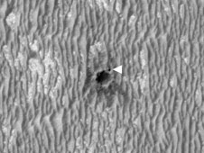
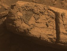
"It was clear from the images that Opportunity took on the approach to Concepción that there was strange stuff on lots of the rocks near the crater," said Steve Squyres of Cornell University, Ithaca, N.Y., principal investigator for Opportunity and its twin rover, Spirit. "There's dark, grayish material coating faces of the rocks and filling fractures in them. At least part of it is composed of blueberries jammed together as close as you could pack them. We've never seen anything like this before."

Opportunity used tools on its robotic arm to examine this unusual material on a rock called "Chocolate Hills." In some places, the layer of closely packed spheres lies between thinner, smoother layers. "It looks like a blueberry sandwich," said Matt Golombek, a rover science-team member at NASA's Jet Propulsion Laboratory, Pasadena, Calif.

Initial analysis of the coating's composition does not show any obvious component from whatever space rock hit Mars to dig the crater, but that is not a surprise, Golombek said. "The impact is so fast, most of the impactor vaporizes," he said. "Thin films of melt get thrown out, but typically the composition of the melt is the stuff that the impactor hit, rather than the impactor material."

The composition Opportunity found for the dark coating material fits at least two hypotheses being evaluated, and possibly others. One is that the material resulted from partial melting of blueberry-containing sandstone from the energy of the impact. Another is that it formed from filling of fractures in this type of rock before the impact occurred.

Wednesday, March 24, 2010

NASA Mars Rover Getting Smarter as it Gets Older

NASA's Mars Exploration Rover Opportunity, now in its seventh year on Mars, has a new capability to make its own choices about whether to make additional observations of rocks that it spots on arrival at a new location.

Software uploaded this winter is the latest example of NASA taking advantage of the twin Mars rovers' unanticipated longevity for real Martian test drives of advances made in robotic autonomy for future missions.

Now, Opportunity's computer can examine images that the rover takes with its wide-angle navigation camera after a drive, and recognize rocks that meet specified criteria, such as rounded shape or light color. It can then center its narrower-angle panoramic camera on the chosen target and take multiple images through color filters.


"It's a way to get some bonus science," said Tara Estlin of NASA's Jet Propulsion Laboratory, Pasadena, Calif. She is a rover driver, a senior member of JPL's Artificial Intelligence Group and leader of development for this new software system.

The new system is called Autonomous Exploration for Gathering Increased Science, or AEGIS. Without it, follow-up observations depend on first transmitting the post-drive navigation camera images to Earth for ground operators to check for targets of interest to examine on a later day. Because of time and data-volume constraints, the rover team may opt to drive the rover again before potential targets are identified or before examining targets that aren't highest priority.

The first images taken by a Mars rover choosing its own target show a rock about the size of a football, tan in color and layered in texture. It appears to be one of the rocks tossed outward onto the surface when an impact dug a nearby crater. Opportunity pointed its panoramic camera at this unnamed rock after analyzing a wider-angle photo taken by the rover's navigation camera at the end of a drive on March 4. Opportunity decided that this particular rock, out of more than 50 in the navigation camera photo, best met the criteria that researchers had set for a target of interest: large and dark.

"It found exactly the target we would want it to find," Estlin said. "This checkout went just as we had planned, thanks to many people's work, but it's still amazing to see Opportunity performing a new autonomous activity after more than six years on Mars."

Opportunity can use the new software at stopping points along a single day's drive or at the end of the day's drive. This enables it to identify and examine targets of interest that might otherwise be missed.

"We spent years developing this capability on research rovers in the Mars Yard here at JPL," said Estlin. "Six years ago, we never expected that we would get a chance to use it on Opportunity."