Friday, January 29, 2010

Prometheus: Over Easy

Prometheus as seen by Cassini
Looking for all intents and purposes like a celestial egg after a session in Saturn's skillet, Prometheus displayed its pockmarked, irregular surface for NASA's Cassini spacecraft on Jan. 27, 2010.

Prometheus is one of Saturn's innermost moons. It orbits the gas-giant at a distance of 139,353 kilometers (85,590 miles) and is 86 kilometers (53 miles) across at its widest point. The porous, icy-bodied world was originally discovered by images taken by Voyager 1 back in 1980. You could say this latest "egg-cellent" view has the Cassini science team licking their chops at the thought of future Prometheus images.

This raw, unprocessed image of Prometheus [pro-MEE-thee-us] , taken in visible light, was obtained by Cassini's narrow-angle camera at a distance of approximately 36,000 kilometers (23,000 miles).

The Cassini Equinox Mission is a joint United States and European endeavor. The Jet Propulsion Laboratory, a division of the California Institute of Technology in Pasadena, manages the mission for NASA's Science Mission Directorate, Washington, D.C. The Cassini orbiter was designed, developed and assembled at JPL.

Monday, January 25, 2010

Rover Gives NASA an "Opportunity" to View Interior of Mars

NASA's Mars exploration rover Opportunity is allowing scientists to get a glimpse deep inside Mars.

Perched on a rippled Martian plain, a dark rock not much bigger than a basketball was the target of interest for Opportunity during the past two months. Dubbed "Marquette Island," the rock is providing a better understanding of the mineral and chemical makeup of the Martian interior.

"Marquette Island is different in composition and character from any known rock on Mars or meteorite from Mars," said Steve Squyres of Cornell University in Ithaca, N.Y. Squyres is principal investigator for Opportunity and its twin, Spirit. "It is one of the coolest things Opportunity has found in a very long time."

During six years of roving, Opportunity has found only one other rock of comparable size that scientists conclude was ejected from a distant crater. The rover studied the first such rock during its initial three-month mission. Called "Bounce Rock," that rock closely matched the composition of a meteorite from Mars found on Earth.

Marquette Island is a coarse-grained rock with a basalt composition. The coarseness indicates it cooled slowly from molten rock, allowing crystals time to grow. This composition suggests to geologists that it originated deep in the crust, not at the surface where it would cool quicker and have finer-grained texture.

"It is from deep in the crust and someplace far away on Mars, though exactly how deep and how far we can't yet estimate," said Squyres.

Thursday, January 21, 2010

Public Invited To Pick Pixels on Mars


The most powerful camera aboard a NASA spacecraft orbiting Mars will soon be taking photo suggestions from the public.

Since arriving at Mars in 2006, the High Resolution Imaging Science Experiment, or HiRISE, camera on NASA's Mars Reconnaissance Orbiter has recorded nearly 13,000 observations of the Red Planet's terrain. Each image covers dozens of square miles and reveals details as small as a desk. Now, anyone can nominate sites for pictures.

"The HiRISE team is pleased to give the public this opportunity to propose imaging targets and share the excitement of seeing your favorite spot on Mars at people-scale resolution," said Alfred McEwen, principal investigator for the camera and a researcher at the University of Arizona, Tucson.

The idea to take suggestions from the public follows through on the original concept of the HiRISE instrument, when its planners nicknamed it "the people's camera." The team anticipates that more people will become interested in exploring the Red Planet, while their suggestions for imaging targets will increase the camera's already bountiful science return. Despite the thousands of pictures already taken, less than 1 percent of the Martian surface has been imaged.

Students, researchers and others can view Mars maps using a new online tool to see where images have been taken, check which targets have already been suggested and make new suggestions. "The process is fairly simple," said Guy McArthur, systems programmer on the HiRISE team at the University of Arizona. "With the tool, you can place your rectangle on Mars where you'd like."

McArthur developed the online tool, called "HiWish," with Ross Beyer, principal investigator and research scientist at NASA's Ames Research Center in Moffett Field, Calif., and the SETI Institute in Mountain View, Calif.

In addition to identifying the location on a map, anyone nominating a target will be asked to give the observation a title, explain the potential scientific benefit of photographing the site and put the suggestion into one of the camera team's 18 science themes. The themes include categories such as impact processes, seasonal processes and volcanic processes.

The HiRISE science team will evaluate suggestions and put high-priority ones into a queue. Thousands of pending targets from scientists and the public will be imaged when the orbiter's track and other conditions are right.

Sunday, January 17, 2010

Dune Symmetry Inside Martian Crater

Dune Symmetry Inside Martian Crater
Dunes of sand-sized materials have been trapped on the floors of many Martian craters. This is one example, from a crater in Noachis Terra, west of the giant Hellas impact basin.

The High Resolution Imaging Science Experiment (HiRISE) camera on NASA's Mars Reconnaissance Orbiter captured this view on Dec. 28, 2009.

The dunes here are linear, thought to be due to shifting wind directions. In places, each dune is remarkably similar to adjacent dunes, including a reddish (or dust colored) band on northeast-facing slopes. Large angular boulders litter the floor between dunes.

The most extensive linear dune fields know in the solar system are on Saturn's large moon Titan. Titan has a very different environment and composition, so at meter-scale resolution they probably are very different from Martian dunes.

This image covers a swath of ground about 1.2 kilometers (three-fourth of a mile) wide, centered at 42.7 degrees south latitude, 38.0 degrees east longitude. It is one product from HiRISE observation ESP_016036_1370. The season on Mars is southern-hemisphere autumn. Other image products from this observation are available at http://hirise.lpl.arizona.edu/ESP_016036_1370.

The University of Arizona, Tucson, operates the HiRISE camera, which was built by Ball Aerospace & Technologies Corp., Boulder, Colo. NASA's Jet Propulsion Laboratory, a division of the California Institute of Technology, Pasadena, manages the Mars Reconnaissance Orbiter for the NASA Science Mission Directorate, Washington. Lockheed Martin Space Systems, Denver, is the prime contractor for the project and built the spacecraft.

Wednesday, January 13, 2010

Variations in Soft Soil of 'Troy' (False Color)


The soft soil exposed when wheels of NASA's Mars Exploration Rover Spirit dug into a patch of ground dubbed "Troy" exhibit variations in hue visible in this image, in which the colors have been stretched to emphasize the differences.

Spirit used its panoramic camera during the 1,892nd Martian day, or sol, of the rover's mission on Mars (April 29, 2009) to take the three images combined into this composite image. The three images were taken through filters centered at wavelengths of 750 nanometers, 530 nanometers and 430 nanometers. Spirit had become embedded at Troy by about a week later.

The two rocks near the upper right corner of this view are each about 10 centimeters (4 inches) long and 2 to 3 centimeters (1 inch) wide.

Tuesday, January 12, 2010

NASA to Check for Unlikely Winter Survival of Mars Lander

NASA's Phoenix Mars Lander is visible within this enhanced-color image of the Phoenix landing site taken on Jan. 6
Beginning Jan. 18, NASA's Mars Odyssey orbiter will listen for possible, though improbable, radio transmissions from the Phoenix Mars Lander, which completed five months of studying an arctic Martian site in November 2008.

The solar-powered lander operated two months longer than its three-month prime mission during summer on northern Mars before the seasonal ebb of sunshine ended its work. Since then, Phoenix's landing site has gone through autumn, winter and part of spring. The lander's hardware was not designed to survive the temperature extremes and ice-coating load of an arctic Martian winter.

In the extremely unlikely case that Phoenix survived the winter, it is expected to follow instructions programmed on its computer. If systems still operate, once its solar panels generate enough electricity to establish a positive energy balance, the lander would periodically try to communicate with any available Mars relay orbiters in an attempt to reestablish contact with Earth. During each communications attempt, the lander would alternately use each of its two radios and each of its two antennas.

Odyssey will pass over the Phoenix landing site approximately 10 times each day during three consecutive days of listening this month and two longer listening campaigns in February and March.

"We do not expect Phoenix to have survived, and therefore do not expect to hear from it. However, if Phoenix is transmitting, Odyssey will hear it," said Chad Edwards, chief telecommunications engineer for the Mars Exploration Program at NASA's Jet Propulsion Laboratory, Pasadena, Calif. "We will perform a sufficient number of Odyssey contact attempts that if we don't detect a transmission from Phoenix, we can have a high degree of confidence that the lander is not active."

The amount of sunshine at Phoenix's site is currently about the same as when the lander last communicated, on Nov. 2, 2008, with the sun above the horizon about 17 hours each day. The listening attempts will continue until after the sun is above the horizon for the full 24.7 hours of the Martian day at the lander's high-latitude site. During the later attempts in February or March, Odyssey will transmit radio signals that could potentially be heard by Phoenix, as well as passively listening.

If Odyssey does hear from Phoenix, the orbiter will attempt to lock onto the signal and gain information about the lander's status. The initial task would be to determine what capabilities Phoenix retains, information that NASA would consider in decisions about any further steps.

Monday, January 11, 2010

LRO Team Begins to Release New Image Series

LRO imageThe LROC Team begins a new series of Featured Images highlighting the regions of interest for potential future human and robotic lunar exploration that LRO is imaging for NASA's Constellation Program. There are 50 of these regions, which were selected prior to LRO’s launch based on expert input from the lunar science community and NASA engineers. For each of these 50 regions, the LROC Team is collecting a comprehensive set of image data.

These images, and the associated information products derived from them (such as boulder distribution maps, slope maps and digital terrain models), will guide engineers and scientists as they develop their plans for how they would continue to explore the moon both robotically and with humans.

Lunar scientists have been studying the vast data returned from the Apollo missions for almost 40 years. As a result, much is known about the moon. Even so, there remains much that we do not know about the moon. Accordingly, each of these 50 regions is associated with either an immensely compelling lunar science question or an exploration-enabling resource, or both, that will be useful to future explorers. However, these 50 regions aren't intended as actual NASA landing sites, but instead are representative locations whose study will provide mission planners and lunar scientists working on future human and robotic lunar exploration with lots of data for a comprehensive suite of interesting and relevant terrains all over the lunar surface.

For more information visit here - http://www.nasa.gov/mission_pages/LRO/multimedia/lroimages/lroc-20100107-new-images.html

Thursday, January 07, 2010

NASA's WISE Eye Spies First Glimpse of the Starry Sky

This infrared snapshot of a region in the constellation Carina near the Milky Way was taken shortly after NASA's Wide-field Infrared Survey Explorer (WISE) ejected its cover
NASA's Wide-field Infrared Survey Explorer, or WISE, has captured its first look at the starry sky that it will soon begin surveying in infrared light.

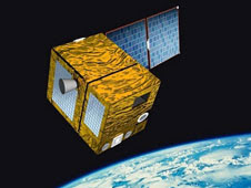
Launched on Dec. 14, WISE will scan the entire sky for millions of hidden objects, including asteroids, "failed" stars and powerful galaxies. WISE data will serve as navigation charts for other missions, such as NASA's Hubble and Spitzer Space Telescopes, pointing them to the most interesting targets the mission finds.

A new WISE infrared image was taken shortly after the space telescope's cover was removed, exposing the instrument's detectors to starlight for the first time. The picture shows about 3,000 stars in the Carina constellation and can be viewed online at http://www.nasa.gov/mission_pages/WISE/multimedia/wise20100106.html .

The image covers a patch of sky about three times larger than the full moon, and was presented today at the 215th meeting of the American Astronomical Society in Washington. The patch was selected because it does not contain any unusually bright objects, which could damage instrument detectors if observed for too long. The picture was taken while the spacecraft was staring at a fixed patch of sky and is being used to calibrate the spacecraft's pointing system.

When the WISE survey begins, the spacecraft will scan the sky continuously as it circles the globe, while an internal scan mirror counteracts its motion. This allows WISE to take "freeze-frame" snapshots every 11 seconds, resulting in millions of images of the entire sky.

"Right now, we are busy matching the rate of the scan mirror to the rate of the spacecraft, so we will capture sharp pictures as our telescope sweeps across the sky," said William Irace, the mission's project manager at NASA's Jet Propulsion Laboratory in Pasadena, Calif.

To sense the infrared glow of stars and galaxies, the WISE spacecraft cannot give off any detectable infrared light of its own. This is accomplished by chilling the telescope and detectors to ultra-cold temperatures. The coldest of WISE's detectors will operate at less than 8 Kelvin, or minus 445 degrees Fahrenheit.

The first sky survey will be complete in six months, followed by a second scan of one-half of the sky lasting three months. The mission ends when the frozen hydrogen that keeps the instrument cold evaporates away, an event expected to occur in October 2010.

Preliminary survey images are expected to be released six months later, in April 2011, with the final atlas and catalog coming 11 months later, in March 2012. Selected images will be released to the public beginning in February 2010.

JPL manages WISE for NASA's Science Mission Directorate in Washington. The mission was competitively selected under NASA's Explorers Program, managed by NASA's Goddard Space Flight Center in Greenbelt, Md. The science instrument was built by the Space Dynamics Laboratory in Logan, Utah, and the spacecraft was built by Ball Aerospace & Technologies Corp. in Boulder, Colo. Science operations and data processing take place at the Infrared Processing and Analysis Center at the California Institute of Technology in Pasadena.

Wednesday, January 06, 2010

Goddard Scientist's Breakthrough Given Ticket to Mars

Jennifer EigenbrodeThe quest to discover whether Mars ever hosted an environment friendly to microscopic forms of life has just gotten a shot in the arm.

"Mars was a lot different 3-1/2 billion years ago. It was more like Earth with liquid water," said Jennifer Eigenbrode, a scientist at the NASA Goddard Space Flight Center in Greenbelt, Md. "Maybe life existed back then. Maybe it has persisted, which is possible given the fact that we've found life in every extreme environment here on Earth. If life existed on Mars, maybe it adapted very much like life adapted here."

An experiment proposed by Eigenbrode has been added to the Sample Analysis at Mars (SAM) instrument on a mobile NASA laboratory that will land on Mars in 2012. Goddard scientists developed SAM. The newly added experiment will enhance SAM's ability to analyze large carbon molecules if the mission is fortunate enough to find any.

The mission, NASA's Mars Science Laboratory, will be checking whether a carefully chosen area of Mars has ever had an environment favorable for the development of life and preservation of evidence about life. The mission's car-sized rover will analyze dozens of samples scooped from soil and drilled from rocks.

None of the rover's 10 instruments is designed to identify past or present life, but SAM has a key role of checking for carbon-containing compounds that potentially can be ingredients or markers of life. Most environments on Mars may not have enabled preservation of these compounds, which are called organic molecules, but if any did, that could be evidence of conditions favorable for life.

Eigenbrode secured the flight opportunity for her experiment after successfully proving in a series of tests earlier this year that the combination of heat and a specific chemical would significantly enhance SAM's ability to analyze large carbon molecules.

Tuesday, January 05, 2010

The PARASOL Satellite Moving Off the A-Train's Track

After nearly 5 years of concurrent operations with the Afternoon Constellation, known as the "A-Train," the PARASOL satellite is going on another orbit "track." The A-Train includes a number of NASA satellites that orbit the Earth one behind the other on the same track and until this month, PARASOL has been part of that train.


PARASOL is an Earth observation mission, managed by the French Space Agency (CNES). PARASOL stands for "Polarization and Anisotropy of Reflectances for Atmospheric Sciences coupled with Observations from a Lidar." According to CNES, it was maneuvered to leave its position inside the A-Train at 12:48 UTC, December 2, 2009.

The A-Train satellite formation currently consists of five satellites flying in close proximity: Aqua, CloudSat, CALIPSO, PARASOL and Aura. Each of these satellites cross the equator within a few minutes of each another at around 1:30 p.m. local time. By combining the different sets of nearly simultaneous observations, scientists are able to gain a better understanding its main mission, studying the important parameters related to climate change. As an additional benefit, the A-Train satellites provide unique information about tropical cyclones, the collective term for tropical depressions, tropical storms, hurricanes and typhoons.