Tuesday, May 18, 2010

NASA Invites Public to Take Virtual Walk on Moon

More than 37 years after humans last walked on the moon, planetary scientists are inviting members of the public to return to the lunar surface as “virtual astronauts” to help answer important scientific questions.

No spacesuit or rocket ship is required -- all visitors need to do is go to www.moonzoo.org and be among the first to see the lunar surface in unprecedented detail. New high-resolution images, taken by NASA’s Lunar Reconnaissance Orbiter Camera (LROC), offer exciting clues to unveil or reveal the history of the moon and our solar system.

“We need Web users around the world to help us interpret these stunning new images of the lunar surface,” said Chris Lintott of Oxford University and chair of the Citizen Science Alliance. “If you only spend five minutes on the site counting craters you’ll be making a valuable contribution to science and, who knows, you might run across a Russian spacecraft.”


Scientists are particularly interested in knowing how many craters appear in a particular region of the moon in order to determine the age and depth of the lunar surface (regolith). Fresh craters left by recent impacts provide clues about the potential risks from meteor strikes on the moon and on Earth.

“We hope to address key questions about the impact bombardment history of the moon and discover sites of geological interest that have never been seen before,” said Katherine Joy of the Lunar and Planetary Institute and a Moon Zoo science team member.

NASA Lunar Science Institute (NLSI) scientists are contributing to the Moon Zoo efforts by providing science expertise. NLSI is also providing educational content and supporting outreach goals of the project.

“The NASA Lunar Science Institute is very excited to be involved with Moon Zoo and support lunar citizen science,” said David Morrison, NLSI director. “Science and public outreach are cornerstones of our Institute; Moon Zoo will contribute to the accomplishment of important science, while being a major step forward in participatory exploration.”

The Moon Zoo Web site is a citizen science project developed by the Citizen Science Alliance, a group of research organizations and museums, and builds on the team's success with Galaxy Zoo, which has involved more than 250,000 people in astronomical research.

“The Lunar Reconnaissance Orbiter Project Science Office is excited to see LRO data being used for citizen science projects,” said Rich Vondrak, LRO project scientist from NASA’s Goddard Space Flight Center, Greenbelt, Md. “The Moon Zoo project provides an opportunity for everyone to participate in analysis of images from the LRO Camera and to make a significant contribution to scientific knowledge about the moon.”

The Lunar Reconnaissance Orbiter mission is managed by NASA's Goddard Space Flight Center, Greenbelt, Md. and the LROC instruments are based out of Arizona State University in Tempe, Az. The NASA Lunar Science Institute is based out of NASA’s Ames Research Center, Moffett Field, Calif.

Thursday, May 06, 2010

HELP HELP NASA Keeping Eyes in the Sky on the Gulf Oil Spill


NASA's Terra satellite flew over the Deepwater Horizon rig's oil spill in the Gulf of Mexico on Saturday, May 1 and captured a natural-color image of the slick from space. The oil slick resulted from an accident at the Deepwater Horizon rig in the Gulf of Mexico.

The Moderate Resolution Imaging Spectroradiometer (MODIS) instrument on NASA’s Terra satellite captured a natural-color image. The oil slick appeared as a tangle of dull gray on the ocean surface, made visible to the satellite sensor by the sun’s reflection on the ocean surface. On May 1, most of the oil slick was southeast of the Mississippi Delta.

The National Oceanic and Atmospheric Administration (NOAA) is the lead agency on oil spills and uses airplane fly-over's to assess oil spill extent. NASA's Terra and Aqua satellites are also helping NOAA with satellite images of the area.

On Sunday, May 2, NOAA restricted fishing in federal waters of the Gulf of Mexico from the mouth of the Mississippi to Pensacola Bay for at least ten days. More details about the closure can be found at: http://sero.nmfs.noaa.gov/. In addition to the federal closure, Louisiana closed vulnerable fisheries in state waters -- within three miles of the coast. NOAA noted that anyone wanting to report oil on land, or for general Community and Volunteer Information, please call 1-866-448-5816. To report oiled or injured wildlife, please call 1-800-557-1401.

Text credit: Rob Gutro, NASA's Goddard Space Flight Center, Greenbelt, Md.

Wednesday, April 28, 2010

Planck Sees a Icy and Violent Orion


The big hunter in the sky is seen in a new light by Planck, a European Space Agency mission with significant NASA participation. The long-wavelength image shows most of the constellation Orion, highlighting turbid clouds of cold material, where new stars are being stirred into existence.

The Planck mission is busy surveying the whole sky at longer wavelengths of light than we can see with our eyes, ranging from infrared to even longer-wavelength microwaves. It is collecting ancient light from when the universe was very young, less than half a million years old, telling us about the birth and fate of our universe. In the process, the mission is gathering data on our Milky Way galaxy that astronomers are using to see through cold pools of gas and dust, which block visible-light views of star formation.

The new image is online at: http://www.nasa.gov/mission_pages/planck/planckorion20100426.html. It shows one such region in our Milky Way, where stars are actively bursting to life. The much-photographed Orion nebula is the bright spot to the lower center. The bright spot to the right of center is around the Horsehead Nebula, so called because at high magnifications a pillar of dust resembles a horse's head. The whole view covers a square patch of sky equivalent to 26 by 26 moons.

"Because Planck is mapping the whole sky, we can capture mosaics of huge regions of the Milky Way," said Charles Lawrence, the NASA project scientist for Planck at NASA's Jet Propulsion Laboratory in Pasadena, Calif. "We are seeing the coldest material in star-forming regions, where stars are at the very earliest stages of formation."


The giant red arc of Barnard's Loop is thought to be the blast wave from a star that blew up inside the region about two million years ago. The bubble it created is now about 300 light-years across.

The picture shows light resulting from two different types of sources. At the lowest frequencies, Planck primarily maps emission from ionized gas heated by newly formed hot stars. At higher frequencies, Planck maps the meager heat emitted by extremely cold dust. This can reveal the coldest cores in the clouds, which are approaching the final stages of collapse, before they are reborn as full-fledged stars.

Monday, April 26, 2010

NASA Conducts Winning Parachute Expansion Test


On April 14, NASA conducted a drogue parachute drop test at the U.S. Army's Yuma Proving Ground near Yuma, Ariz. The 68-foot-diameter drogue and all test hardware functioned properly and landed safely.

The design load limit test will provide engineers with a better understanding of the full structural capabilities of the drogue parachute, currently under development to return next-generation space vehicles safely to Earth.

This was the second in a series of three planned load limit tests designed to place the loads expected in flight on the parachute canopy. The next test series, called overload tests, will subject the parachute canopy to loads greater than what would typically be experienced in flight, to prove the parachute is strong enough to survive some degree of unexpected events.

Future full resolution images of the drogue parachute test will be made publicly available when they are fully processed:

http://www.nasa.gov/ares


When video from the test becomes available, it will air on NASA Television's Video File. For NASA TV downlink, schedule and streaming video information, visit:

http://www.nasa.gov/ntv


Wednesday, April 21, 2010

Lunar Polar Craters May Be Electrified

As the solar wind flows over natural obstructions on the moon, it may charge polar lunar craters to hundreds of volts, according to new calculations by NASA’s Lunar Science Institute team.

Polar lunar craters are of interest because of resources, including water ice, which exist there. The moon’s orientation to the sun keeps the bottoms of polar craters in permanent shadow, allowing temperatures there to plunge below minus 400 degrees Fahrenheit, cold enough to store volatile material like water for billions of years. "However, our research suggests that, in addition to the wicked cold, explorers and robots at the bottoms of polar lunar craters may have to contend with a complex electrical environment as well, which can affect surface chemistry, static discharge, and dust cling," said William Farrell of NASA’s Goddard Space Flight Center, Greenbelt, Md. Farrell is lead author of a paper on this research published March 24 in the Journal of Geophysical Research. The research is part of the Lunar Science Institute’s Dynamic Response of the Environment at the moon (DREAM) project.

"This important work by Dr. Farrell and his team is further evidence that our view on the moon has changed dramatically in recent years," said Gregory Schmidt, deputy director of the NASA Lunar Science Institute at NASA's Ames Research Center, Moffett Field, Calif. "It has a dynamic and fascinating environment that we are only beginning to understand."

Solar wind inflow into craters can erode the surface, which affects recently discovered water molecules. Static discharge could short out sensitive equipment, while the sticky and extremely abrasive lunar dust could wear out spacesuits and may be hazardous if tracked inside spacecraft and inhaled over long periods.

The solar wind is a thin gas of electrically charged components of atoms -- negatively charged electrons and positively charged ions -- that is constantly blowing from the surface of the sun into space. Since the moon is only slightly tilted compared to the sun, the solar wind flows almost horizontally over the lunar surface at the poles and along the region where day transitions to night, called the terminator.

The researchers created computer simulations to discover what happens when the solar wind flows over the rims of polar craters. They discovered that in some ways, the solar wind behaves like wind on Earth -- flowing into deep polar valleys and crater floors. Unlike wind on Earth, the dual electron-ion composition of the solar wind may create an unusual electric charge on the side of the mountain or crater wall; that is, on the inside of the rim directly below the solar wind flow.

Monday, April 19, 2010

NASA Celebrates Earth Day 2010 on the National Mall

NASA is taking part in the celebration of Earth Day's fortieth anniversary on the National Mall in Washington beginning Saturday, April 17. The agency's involvement is much expanded over previous years and includes 9 consecutive days of activities and exhibits open to the public.

The 'NASA Village,' which contains three domed tents, will highlight the use of NASA science and technology to advance knowledge and awareness about our home planet and sustain our environment. The area is located on the Mall one block west of 12th Street and the Smithsonian Metro station entrance. On the weekend of April 17-18, a performance stage at 12th Street will also feature NASA presentations along with a wide variety of entertainment organized by the Earth Day Network.

The Science Tent which will host exhibits and hands-on demonstrations. The Cinema Tent will feature multimedia presentations by NASA scientists and others. The Technology Tent will present exhibits and demonstrations on a wide range of NASA environmental technologies.

Monday, April 12, 2010

NASA Announces Winners of 17th Annual Great Moonbuggy Race

NASA has announced the victors in the 17th annual Great Moonbuggy Race: The team representing the International Space Education Institute of Leipzig, Germany, won the high school division; and racers from the University of Puerto Rico in Humacao took first place in the college division.

The teams bested more than 70 teams from 18 states, Puerto Rico, Canada, Germany, India and Romania. More than 600 drivers, engineers and mechanics -- all students -- gathered with their team advisors and cheering sections to take part in the matchup of wits and wheels at the U.S. Space & Rocket Center April 9-10 in Huntsville, Ala.

The race is organized by NASA's Marshall Space Flight Center in Huntsville. It challenges students to design, build and race lightweight, human-powered buggies that tackle many of the same engineering challenges dealt with by Apollo-era lunar rover developers at the Marshall Center in the late 1960s.

The International Space Education Institute of Leipzig, Germany, won the high school division of the 2010 Great Moonbuggy Race

The International Space Education Institute, known among moonbuggy racers as "Team Germany," has been a prominent contender in the competition since they debuted in 2007 as the German Space Education Institute. Their team this year included two Russian students, reflecting the school's expanded international scope.

The University of Puerto Rico in Humacao -- the only school in the world to enter a moonbuggy in every race since the event was founded in 1994 -- won the second-place prize in 2009, and finally took home first place in this, their 17th appearance.

The winning teams posted the fastest vehicle assembly and race times in their divisions and received the fewest on-course penalties. The International Space Education Institute finished the roughly half-mile course -- twisting curves, treacherous gravel pits and other obstacles simulating lunar surface conditions -- in just 3 minutes 37 seconds. The University of Puerto Rico at Humacao posted a time of 4 minutes 18 seconds.

Finishing in second place this year in the high school division was Fajardo Vocational High School of Humacao, Puerto Rico, which entered the competition for the first time in 2009. Third place in the high school division yielded a tie: race newcomer Jupiter High School of Jupiter, Fla., matched perennial top-three winner Huntsville Center for Technology Team 1 of Huntsville, Ala. -- who also tied last year for the top high school trophy.

The University of Utah from Salt Lake City won second place in the college division, boosting them onto the trophy platform for the first time since they debuted in the race in 2007; and the Rhode Island School of Design from Providence, R.I., took home third place in their first race appearance -- despite having no engineers on their team (all team members are industrial design students).

Race organizers presented both first-place winners with trophies depicting NASA's original lunar rover. NASA also gave plaques and certificates to every team that competed.

The first-place high school team also received $500 and a week at Space Camp, courtesy of race sponsors ATK Aerospace Systems of Huntsville. ATK awarded the second- and third-place high school teams $250 each. Race sponsor Lockheed Martin Corp. of Huntsville also presented the winning college team with $5,700 in cash.

Individuals on the winning teams also received commemorative medals and other prizes. (For a complete list of additional awards for design, safety, innovation and spirit, see below.)

"Each year, NASA's Great Moonbuggy Race clearly demonstrates the popularity, worldwide reach and intrinsic value of the agency's education initiatives," said Tammy Rowan, manager of the Marshall Center's Academic Affairs Office, which organizes the race. "It's our goal to augment and enrich the classroom experience, and inspire a new generation of scientists, engineers and explorers to carry on NASA's mission of discovery throughout our solar system and deliver untold benefits back home on Earth."

The moonbuggy race is inspired by the original lunar rover, first piloted across the moon's surface in the early 1970s during the Apollo 15, 16 and 17 missions. The first race, held in 1994, commemorated the 25th anniversary of the Apollo 11 lunar landing. At the time, the event was only open to college teams, and eight participated. Two years later, the event was expanded to include high school teams.

NASA's Great Moonbuggy Race is hosted each year by the U.S. Space & Rocket Center. Major corporate sponsorship is provided by Lockheed Martin Corp., The Boeing Company, Northrop Grumman Corp., and Jacobs Engineering ESTS Group, all of Huntsville

Wednesday, April 07, 2010

Small Companion to Brown Dwarf


NASA
- As our telescopes grow more powerful, astronomers are uncovering objects that defy conventional wisdom. The latest example is the discovery of a planet-like object circling a brown dwarf. It's the right size for a planet, estimated to be 5-10 times the mass of Jupiter. But the object formed in less than 1 million years -- the approximate age of the brown dwarf -- and much faster than the predicted time it takes to build planets according to some theories.

Kamen Todorov of Penn State University and co-investigators used the keen eyesight of the Hubble Space Telescope and the Gemini Observatory to directly image the companion of the brown dwarf, which was uncovered in a survey of 32 young brown dwarfs in the Taurus star-forming region. Brown dwarfs are objects that typically are tens of times the mass of Jupiter and are too small to sustain nuclear fusion to shine as stars do.

The mystery object orbits the nearby brown dwarf at a separation of approximately 2.25 billion miles (3.6 billion kilometers -- which is between the distances of Saturn and Uranus from the Sun). The team's research is being published in an upcoming issue of The Astrophysical Journal.

There has been a lot of discussion in the context of the Pluto debate over how small an object can be and still be called a planet. This new observation addresses the question at the other end of the size spectrum: How small can an object be and still be a brown dwarf rather than a planet? This new companion is within the range of masses observed for planets around stars -- less than 15 Jupiter masses. But should it be called a planet? The answer is strongly connected to the mechanism by which the companion most likely formed.

There are three possible formation scenarios: Dust in a circumstellar disk slowly agglomerates to form a rocky planet 10 times larger than Earth, which then accumulates a large gaseous envelope; a lump of gas in the disk quickly collapses to form an object the size of a gas giant planet; or, rather than forming in a disk, a companion forms directly from the collapse of the vast cloud of gas and dust in the same manner as a star (or brown dwarf).

If the last scenario is correct, then this discovery demonstrates that planetary-mass bodies can be made through the same mechanism that builds stars. This is the likely solution because the companion is too young to have formed by the first scenario, which is very slow. The second mechanism occurs rapidly, but the disk around the central brown dwarf probably did not contain enough material to make an object with a mass of 5-10 Jupiter masses.

"The most interesting implication of this result is that it shows that the process that makes binary stars extends all the way down to planetary masses. So it appears that nature is able to make planetary-mass companions through two very different mechanisms," says team member Kevin Luhman of the Center for Exoplanets and Habitable Worlds at Penn State University. If the mystery companion formed through cloud collapse and fragmentation, as stellar binary systems do, then it is not a planet by definition because planets build up inside disks.

The mass of the companion is estimated by comparing its brightness to the luminosities predicted by theoretical evolutionary models for objects at various masses for an age of 1 millon years.

Friday, April 02, 2010

NASA theme 'A Question to the World'

Imagine a close flyby mission to Mars, where micro sensors are deposited into the atmosphere over half an orbit or more.

The sensors, captured by the atmospheric drag and Martian gravity, slowly descend, buffeted about by Martian winds and weather until they settle on the surface a great time later. (Think of how long dust takes to settle.)

As they descend they communicate a vast array of data: temperature, chemistry, pressure, electric or magnetic properties from a huge region of the planet and an individual sensor need not measure the same quantity as its neighbors.

Initially they could move at the whim of the environment, but later versions could have locomotion or propulsion mechanisms. Humans wouldn't need to decide where they go, they do that for themselves.

This is a key strength of a sensor swarm. The intelligence relies on the group, not on a decision-maker on Earth. Real-time sensor inputs direct what the swarm considers most interesting to investigate resulting in "emergent behavior."

Ans - Because an idea can come from anywhere, Mel Ferebee and Erik Vedeler are leading an initiative to get more people involved in NASA's innovation process. They decided to "issue a question to the world and have the wisdom and knowledge of the crowd solve it," said Ferebee, who heads up the Participatory Exploration team at NASA Langley. To make that wisdom and knowledge flow, it was necessary to prime the pump.

"You motivate the crowd with an award, in this case $20,000," Ferebee said. The deadline for answers is April 26, and more than 250 have been filed so far. The program is part of a desire to interact with the public in a new and different way. Most of that interaction now comes from the agency and its centers, answering questions it asks itself, then issuing white papers or being interviewed for scientific stories to communicate that information.

"But the smartest people sometimes aren't at NASA's Langley Research Center," Ferebee said. "The thought is that we can be innovative by getting the collective knowledge, by getting the folks outside the NASA gate engaged in our problem." With that aim, Ferebee sought questions from among the nine strategic opportunity teams, which were set up to find problems and sell Langley's ability to solve them.

Enter Vedeler, who heads the Frontier Sensors Strategic Opportunity team. His group is seeking new and different ways to use sensors, and Vedeler has a particular interest in the potential of sensor swarms in exploration.

"If you think about the human brain, you've got millions of neurons, and it's the interconnectivity of these simple things that makes our brain as complex as it is," he said, explaining the logic of sensor swarms. He also points to the collective actions of flocks of birds and schools of fish in avoiding prey or finding food. Linking the concept to exploration wasn't difficult.

"I just had in my own mind, suppose you want to send a probe to Mars?" Vedeler said. "You want to know the atmospheric chemistry and dynamics. You might want to know about methane. You might want to know about other measurable life signs.

"So you go there, but rather than having a probe like we've always done, Viking or Sojourner or Spirit and Opportunity, where single things come down at a single place on the planet to collect information" you instead have a vehicle fly over the planet and open a tank to release micro sensors into the atmosphere that could number in the tens of thousands."

On their way to the planet's surface, the sensors measure different things and communicate with each other, forming a sort of artificial brain. Perhaps they have locomotion. Above all, they are relatively cheap and plentiful.

"The swarming concept implies that with 80 percent sensor failure you can still have 100 percent mission success," Vedeler said. "Evidence in biological systems supports these numbers." With all of that as background, "how do you convert it to something that's engineering?" he added. "That's the challenge." With a grant of $46,000, including logistics with Innocentive.com, a research firm, and the prize money, Ferebee is seeking the answer from the general public.

"The thought is that we can be innovative by getting the collective knowledge of folks outside the NASA gate involved in our problem," Ferebee said. That they might not be scientists or engineers has occurred to him and Vedeler and is not an issue. Ferebee tells the story of a concrete manufacturer who helped solve the problem of cleaning up the Exxon Valdez oil spill in Price Edward Sound in Alaska offering a chemical that was used to get concrete over long distances.

"It turns out that it also can be used to break down oil and make it slush enough to pump out," Ferebee said.

And, at Johnson Space Center, which pioneered the innovation challenge process, people are seeking a way to predict solar events that generate radiation that can be dangerous to humans exploring the moon or other planets.

"They are providing an awful lot of data," Ferebee said. "You would think that all of the radiation guys are looking through all of this data, but that doesn't mean that stockbrokers, who also deal with a lot of data, can't look through it and find trends because that's what they look for."

So biologists could offer the answer to sensor swarms exploring Mars, Vedeler said. Or computer scientists used to working with swarms of information on the Internet. Or anybody. Or nobody. They are seeking an algorithm, but perhaps it's a problem that can't be answered in a $20,000 challenge. If there's no acceptable answer, there's no payment.

Tuesday, March 30, 2010

1980s Video Icon burns on Saturn Moon

The highest-resolution-yet temperature map and images of Saturn's icy moon Mimas obtained by NASA's Cassini spacecraft reveal surprising patterns on the surface of the small moon, including unexpected hot regions that resemble "Pac-Man" eating a dot, and striking bands of light and dark in crater walls.

"Other moons usually grab the spotlight, but it turns out Mimas is more bizarre than we thought it was," said Linda Spilker, Cassini project scientist at NASA's Jet Propulsion Laboratory in Pasadena, Calif. "It has certainly given us some new puzzles."

This figure illustrates the unexpected and bizarre pattern of daytime temperatures found on Saturn's small inner moon Mimas

Cassini collected the data on Feb. 13, during its closest flyby of the moon, which is marked by an enormous scar called Herschel Crater and resembles the Death Star from "Star Wars."

Scientists working with the composite infrared spectrometer, which mapped Mimas' temperatures, expected smoothly varying temperatures peaking in the early afternoon near the equator. Instead, the warmest region was in the morning, along one edge of the moon's disk, making a sharply defined Pac-Man shape, with temperatures around 92 Kelvin (minus 294 degrees Fahrenheit). The rest of the moon was much colder, around 77 Kelvin (minus 320 degrees Fahrenheit). A smaller warm spot - the dot in Pac-Man's mouth - showed up around Herschel, with a temperature around 84 Kelvin (minus 310 degrees Fahrenheit).

The warm spot around Herschel makes sense because tall crater walls (about 5 kilometers, or 3 miles, high) can trap heat inside the crater. But scientists were completely baffled by the sharp, V-shaped pattern.

"We suspect the temperatures are revealing differences in texture on the surface," said John Spencer, a Cassini composite infrared spectrometer team member based at Southwest Research Institute in Boulder, Colo. "It's maybe something like the difference between old, dense snow and freshly fallen powder."

Denser ice quickly conducts the heat of the sun away from the surface, keeping it cold during the day. Powdery ice is more insulating and traps the sun's heat at the surface, so the surface warms up.

Even if surface texture variations are to blame, scientists are still trying to figure out why there are such sharp boundaries between the regions, Spencer said. It is possible that the impact that created Herschel Crater melted surface ice and spread water across the moon. That liquid may have flash-frozen into a hard surface. But it is hard to understand why this dense top layer would remain intact when meteorites and other space debris should have pulverized it by now, Spencer said.

Thursday, March 25, 2010

Mars Rover Examines Odd Material at Small, Young Crater

This image shows NASA's Mars Exploration Rover Opportunity perched on the edge of
Weird coatings on rocks beside a young Martian crater remain puzzling after a preliminary look at data from examination of the site by NASA's Opportunity rover.

The rover spent six weeks investigating the crater called "Concepción" before resuming its long journey this month. The crater is about 10 meters (33 feet) in diameter. Dark rays extending from it, as seen from orbit, flagged it in advance as a target of interest because the rays suggest the crater is young.

The rocks ejected outward from the impact that dug Concepción are chunks of the same type of bedrock Opportunity has seen at hundreds of locations since landing in January 2004: soft, sulfate-rich sandstone holding harder peppercorn-size dark spheres like berries in a muffin. The little spheres, rich in iron, gained the nickname "blueberries."

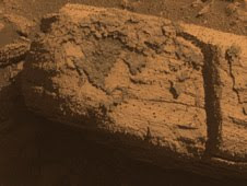
This image from the panoramic camera on NASA's Mars Exploration Rover Opportunity shows a rock called "It was clear from the images that Opportunity took on the approach to Concepción that there was strange stuff on lots of the rocks near the crater," said Steve Squyres of Cornell University, Ithaca, N.Y., principal investigator for Opportunity and its twin rover, Spirit. "There's dark, grayish material coating faces of the rocks and filling fractures in them. At least part of it is composed of blueberries jammed together as close as you could pack them. We've never seen anything like this before."

Opportunity used tools on its robotic arm to examine this unusual material on a rock called "Chocolate Hills." In some places, the layer of closely packed spheres lies between thinner, smoother layers. "It looks like a blueberry sandwich," said Matt Golombek, a rover science-team member at NASA's Jet Propulsion Laboratory, Pasadena, Calif.

Initial analysis of the coating's composition does not show any obvious component from whatever space rock hit Mars to dig the crater, but that is not a surprise, Golombek said. "The impact is so fast, most of the impactor vaporizes," he said. "Thin films of melt get thrown out, but typically the composition of the melt is the stuff that the impactor hit, rather than the impactor material."

The composition Opportunity found for the dark coating material fits at least two hypotheses being evaluated, and possibly others. One is that the material resulted from partial melting of blueberry-containing sandstone from the energy of the impact. Another is that it formed from filling of fractures in this type of rock before the impact occurred.

Wednesday, March 24, 2010

NASA Mars Rover Getting Smarter as it Gets Older

NASA's Mars Exploration Rover Opportunity, now in its seventh year on Mars, has a new capability to make its own choices about whether to make additional observations of rocks that it spots on arrival at a new location.

Software uploaded this winter is the latest example of NASA taking advantage of the twin Mars rovers' unanticipated longevity for real Martian test drives of advances made in robotic autonomy for future missions.

Now, Opportunity's computer can examine images that the rover takes with its wide-angle navigation camera after a drive, and recognize rocks that meet specified criteria, such as rounded shape or light color. It can then center its narrower-angle panoramic camera on the chosen target and take multiple images through color filters.


"It's a way to get some bonus science," said Tara Estlin of NASA's Jet Propulsion Laboratory, Pasadena, Calif. She is a rover driver, a senior member of JPL's Artificial Intelligence Group and leader of development for this new software system.

The new system is called Autonomous Exploration for Gathering Increased Science, or AEGIS. Without it, follow-up observations depend on first transmitting the post-drive navigation camera images to Earth for ground operators to check for targets of interest to examine on a later day. Because of time and data-volume constraints, the rover team may opt to drive the rover again before potential targets are identified or before examining targets that aren't highest priority.

The first images taken by a Mars rover choosing its own target show a rock about the size of a football, tan in color and layered in texture. It appears to be one of the rocks tossed outward onto the surface when an impact dug a nearby crater. Opportunity pointed its panoramic camera at this unnamed rock after analyzing a wider-angle photo taken by the rover's navigation camera at the end of a drive on March 4. Opportunity decided that this particular rock, out of more than 50 in the navigation camera photo, best met the criteria that researchers had set for a target of interest: large and dark.

"It found exactly the target we would want it to find," Estlin said. "This checkout went just as we had planned, thanks to many people's work, but it's still amazing to see Opportunity performing a new autonomous activity after more than six years on Mars."

Opportunity can use the new software at stopping points along a single day's drive or at the end of the day's drive. This enables it to identify and examine targets of interest that might otherwise be missed.

"We spent years developing this capability on research rovers in the Mars Yard here at JPL," said Estlin. "Six years ago, we never expected that we would get a chance to use it on Opportunity."

Tuesday, March 23, 2010

Experience Hubble's Universe in 3-D


Take an exhilarating ride through the Orion Nebula, a vast star-making factory 1,500 light-years away. Swoop through Orion's giant canyon of gas and dust. Fly past behemoth stars whose brilliant light illuminates and energizes the entire cloudy region. Zoom by dusty tadpole-shaped objects that are fledgling solar systems.

This virtual space journey isn't the latest video game but one of several groundbreaking astronomy visualizations created by specialists at the Space Telescope Science Institute (STScI) in Baltimore, the science operations center for NASA's Hubble Space Telescope. The cinematic space odysseys are part of the new Imax film "Hubble 3D," which opens today at select Imax theaters worldwide.

The 43-minute movie chronicles the 20-year life of Hubble and includes highlights from the May 2009 servicing mission to the Earth-orbiting observatory, with footage taken by the astronauts.

The giant-screen film showcases some of Hubble's breathtaking iconic pictures, such as the Eagle Nebula's "Pillars of Creation," as well as stunning views taken by the newly installed Wide Field Camera 3.

While Hubble pictures of celestial objects are awe-inspiring, they are flat 2-D photographs. For this film, those 2-D images have been converted into 3-D environments, giving the audience the impression they are space travelers taking a tour of Hubble's most popular targets.

"A large-format movie is a truly immersive experience," says Frank Summers, an STScI astronomer and science visualization specialist who led the team that developed the movie visualizations. The team labored for nine months, working on four visualization sequences that comprise about 12 minutes of the movie.

"Seeing these Hubble images in 3-D, you feel like you are flying through space and not just looking at picture postcards," Summers continued. "The spacescapes are all based on Hubble images and data, though some artistic license is necessary to produce the full depth of field needed for 3-D."

The most ambitious sequence is a four-minute voyage through the Orion Nebula's gas-and-dust canyon, about 15 light-years across. During the ride, viewers will see bright and dark, gaseous clouds; thousands of stars, including a grouping of bright, hefty stars called the Trapezium; and embryonic planetary systems. The tour ends with a detailed look at a young circumstellar disk, which is much like the structure from which our solar system formed 4.5 billion years ago.

Based on a Hubble image of Orion released in 2006, the visualization was a collaborative effort between science visualization specialists at STScI, including Greg Bacon, who sculpted the Orion Nebula digital model, with input from STScI astronomer Massimo Roberto; the National Center for Supercomputing Applications at the University of Illinois at Urbana-Champaign; and the Spitzer Science Center at the California Institute of Technology in Pasadena.

For some of the sequences, STScI imaging specialists developed new techniques for transforming the 2-D Hubble images into 3-D. STScI image processing specialists Lisa Frattare and Zolt Levay, for example, created methods of splitting a giant gaseous pillar in the Carina Nebula into multiple layers to produce a 3-D effect, giving the structure depth. The Carina Nebula is a nursery for baby stars.

Frattare painstakingly removed the thousands of stars in the image so that Levay could separate the gaseous layers on the isolated Carina pillar. Frattare then replaced the stars into both foreground and background layers to complete the 3-D model. For added effect, the same separation was done for both visible and infrared Hubble images, allowing the film to cross-fade between wavelength views in 3-D.

In another sequence viewers fly into a field of 170,000 stars in the giant star cluster Omega Centauri. STScI astronomer Jay Anderson used his stellar database to create a synthetic star field in 3-D that matches recent razor-sharp Hubble photos.

The film's final four-minute sequence takes viewers on a voyage from our Milky Way Galaxy past many of Hubble's best galaxy shots and deep into space. Some 15,000 galaxies from Hubble's deepest surveys stretch billions of light-years across the universe in a 3-D sequence created by STScI astronomers and visualizers. The view dissolves into a cobweb that traces the universe's large-scale structure, the backbone from which galaxies were born.

In addition to creating visualizations, STScI's education group also provided guidance on the "Hubble 3D" Educator Guide, which includes standards-based lesson plans and activities about Hubble and its mission. Students will use the guide before or after seeing the movie.

Wednesday, March 17, 2010

Three FASTSAT Instruments Pass Tests

The outer layers of Earth's atmosphere hold many secrets yet to be uncovered and three scientific instruments will fly soon on the FASTSAT-HSV01 satellite and seek to uncover them to benefit us here on Earth. Known as MINI-ME, PISA and TTI, these instruments recently passed a series of important final tests to prove their readiness for spaceflight.

These instruments were conceived and built at NASA's Goddard Space Flight Center in Greenbelt, Md., and were integrated to the satellite and tested at NASA's Marshall Spaceflight Center, Huntsville, Ala.


MINI-ME, acronym for Miniature Imager for Neutral Ionospheric atoms and Magnetospheric Electrons, is a low energy neutral atom imager which will detect neutral atoms formed in the plasma population of the Earth's outer atmosphere to improve global space weather prediction. Low energy neutral atom imaging is a technique first pioneered at Goddard which allows scientists to observe remotely various trapped charged particle populations around Earth that we would normally only be able to observe in-situ through direct instrument contact with the particles.

Michael Collier, Principal Investigator for the MINI-ME instrument at NASA Goddard said, "The satellite has gone through vibration, thermal, and Electromagnetic Interference (EMI) tests and everything looks great. The MINI-ME instrument is performing as expected."

PISA is an acronym for the Plasma Impedance Spectrum Analyzer, which will test a new measurement technique for the thermal electron populations in the ionosphere, and their density structuring, which can interfere with or scatter radio signals used for communication and navigation. PISA will tell scientists on Earth when and where the ionosphere becomes structured or turbulent. That will give us better predictions of how space weather will affect GPS signals.

Doug Rowland, PISA's Principal Investigator at NASA Goddard said, "PISA has completed the same tests that the Mini-ME endured and has just passed powered Electromagnetic Interference Test. PISA is on track for spacecraft to be packed up and delivered to the launch site." The EMI, vibration and thermal testing are critical tests for all instruments and satellites before they're loaded aboard a rocket and put into orbit.

Tuesday, March 16, 2010

The Lunar Far Side as Seen by the Lunar Orbiter Laser Altimeter


Topography data from the Lunar Orbiter Laser Altimeter (LOLA) aboard the Lunar Reconnaissance Orbiter reveal a violent impact history on the far side of the Moon. Scientists are using LOLA data to identify and map the distribution of impact craters and basins on the lunar surface, which in turn reveals information about the age of the lunar crust and early bombardment of the Solar System.

Friday, March 12, 2010

A Mosaic of Cassiopeia


This mosaic of images from the Wide-Field Infrared Survey Explore, or WISE, in the constellation of Cassiopeia contains a large star-forming nebula within the Milky Way Galaxy, called IC 1805 or the Heart Nebula, a portion of which is seen at the right of the image. IC 1805 is more than 6,000 light-years from Earth. Also visible in this image are two nearby galaxies, Maffei 1 and Maffei 2. In visible light these galaxies are hidden by dust in IC 1805 and were unknown until 1968 when Paolo Maffei found them using infrared observations. Both galaxies contain billions of stars and are located some 10 million light-years away. Maffei 1 is a lenticular galaxy, which has a disk-like structure and a central bulge but no spiral structure or appreciable dust content. Maffei 2 is a spiral galaxy that also has a disk shape, but with a bar-like central bulge and two prominent dusty spiral arms.

Thursday, March 11, 2010

Ancient Galaxies Come Together after Billions of Years

Imagine finding a living dinosaur in your backyard. Astronomers have found the astronomical equivalent of prehistoric life in our intergalactic back yard: a group of small, ancient galaxies that has waited 10 billion years to come together. These "late bloomers" are on their way to building a large elliptical galaxy.


Such encounters between dwarf galaxies are normally seen billions of light-years away and therefore occurred billions of years ago. But these galaxies, members of Hickson Compact Group 31, are relatively nearby, only 166 million light-years away.

New images of these galaxies by NASA's Hubble Space Telescope offer a window into what commonly happened in the universe's formative years when large galaxies were created from smaller building blocks. The Hubble observations have added important clues to the story of this interacting foursome, allowing astronomers to determine when the encounter began and to predict a future merger.

Astronomers know the system has been around for a while because the oldest stars in a few of its ancient globular clusters are about 10 billion years old. The encounter, though, has been going on for about a few hundred million years, the blink of an eye in cosmic history. Everywhere the astronomers looked in this compact group they found batches of infant star clusters and regions brimming with star birth. Hubble reveals that the brightest clusters, hefty groups each holding at least 100,000 stars, are less than 10 million years old.

The entire system is rich in hydrogen gas, the stuff of which stars are made. Astronomers used Hubble's Advanced Camera for Surveys to resolve the youngest and brightest of those clusters, which allowed them to calculate the clusters' ages, trace the star-formation history, and determine that the galaxies are undergoing the final stages of galaxy assembly.

The composite image of Hickson Compact Group 31 shows the four galaxies mixing it up. The bright, distorted object at middle, left, is actually two colliding dwarf galaxies. The bluish star clusters have formed in the streamers of debris pulled from the galaxies and at the site of their head-on collision. The cigar-shaped object above the galaxy duo is another member of the group. A bridge of star clusters connects the trio. A longer rope of bright star clusters points to the fourth member of the group, at lower right. The bright object in the center is a foreground star. The image was composed from observations made by the Hubble Space Telescope's Advanced Camera for Surveys, NASA's Spitzer Space Telescope, and the Galaxy Evolution Explorer (GALEX).

Monday, March 08, 2010

Smooth Sailing by Rhea and Helene

Amanda Hendrix ScientistCassini's closest-ever flyby of Saturn's moon Rhea went quite smoothly and teams are busy checking out their data! These flybys never fail to amaze me. And the raw images -- which give us an unprocessed first look -- are really cool!

Raw image N00152150 gives us a view of part of the bright, fractured terrain we refer to as "wispy terrain" from about 14,000 kilometers (8,900 miles) away. We know that Rhea's albedo overall is quite high. (When I say "albedo," I basically mean "brightness" or "reflectivity." Studying the albedo can tell a lot about surface composition, geologic processes, and interactions with external environment.) But this image demonstrates how bright these cracks are since they are so shiny that the surrounding terrain looks quite dark. There are also some interesting apparent albedo variations seen in this image, which are really intriguing.

This raw image (N00152175) from Cassini's narrow-angle camera image was taken about 40 minutes after closest approacha. The image shows a region adjacent to the wispy terrain --craters, craters everywhere! And wow, are those crater rims bright compared to the surrounding terrain.

Cassini captured a full portrait of the serene moon with its wide-angle camera (raw image W00063107) on the outbound leg of the flyby, about 1.25 hours after closest approach. Keep in mind that the phase angle is quite low here (only about 2.5 degrees), meaning that the sun is almost directly behind Cassini and Rhea is nearly fully illuminated -- so there are no shadows. Large-scale albedo variations are apparent across the surface.


The spacecraft also obtained a cool image of little Helene with raw image N00152211 . We're basically looking at the night side of the body -- but it doesn't appear very dark, because it's illuminated by sunlight reflecting off Saturn. During the later image sequence of Helene, this small moon was transiting Saturn - so you can see Saturn in the background.

Sometimes,pointing at these little guys can be very tricky, especially so close after a targeted flyby. It can be difficult (or impossible!) to get the positions of the spacecraft, the moon and the instruments all lined up -- but boy are these close-up Helene images incredible! The detail on the surface is tremendous, and should go a long way to informing geologists about surface properties and processes.

Supermassive black holes may play an important role in the evolution of the galaxies :NASA's Chandra X-ray Observatory


New observations from NASA's Chandra X-ray Observatory provide evidence for powerful winds blowing away from the vicinity of a supermassive black hole in a nearby galaxy. This discovery indicates that "average" supermassive black holes may play an important role in the evolution of the galaxies in which they reside.

For years, astronomers have known that a supermassive black hole grows in parallel with its host galaxy. And, it has long been suspected that material blown away from a black hole -- as opposed to the fraction of material that falls into it -- alters the evolution of its host galaxy.

A key question is whether such "black hole blowback" typically delivers enough power to have a significant impact. Powerful relativistic jets shot away from the biggest supermassive black holes in large, central galaxies in clusters like Perseus are seen to shape their host galaxies, but these are rare. What about less powerful, less focused galaxy-scale winds that should be much more common?

"We're more interested here in seeing what an "average"-sized supermassive black hole can do to its galaxy, not the few, really big ones in the biggest galaxies," said Dan Evans of the Massachusetts Institute of Technology who presented these results at the High Energy Astrophysics Division of the American Astronomical Society meeting in Kona, Hawaii.

Evans and his colleagues used Chandra for five days to observe NGC 1068, one of the nearest and brightest galaxies containing a rapidly growing supermassive black hole. This black hole is only about twice as massive as the one in the center of our Galaxy, which is considered to be a rather ordinary size.

The X-ray images and spectra obtained using Chandra's High Energy Transmission Grating Spectrometer showed that a strong wind is being driven away from the center of NGC 1068 at a rate of about a million miles per hour. This wind is likely generated as surrounding gas is accelerated and heated as it swirls toward the black hole. A portion of the gas is pulled into the black hole, but some of it is blown away. High energy X-rays produced by the gas near the black hole heat the ouflowing gas, causing it to glow at lower X-ray energies.

This study by Evans and colleagues represents the first X-ray observation that is deep enough to make a high quality map of the cone-shaped volume lit up by the black hole and its winds. By combining measurement of the velocity of the clouds with estimates of the density of the gas, Evans and his colleagues showed that each year several times the mass of the Sun is being deposited out to large distances, about 3,000 light years from the black hole. The wind may carry enough energy to heat the surrounding gas and suppress extra star formation.

"We have shown that even these middle-of-the-road black holes can pack a punch," said Evans. "I think the upshot is that these black holes are anything but ordinary."

Further studies of other nearby galaxies will examine the impact of other AGN outflows, leading to improvements in our understanding of the evolution of both galaxies and black holes.

"In the future, our own Galaxy's black hole may undergo similar activity, helping to shut down the growth of new stars in the central region of the Milky Way," said Evans.

These new results provide a key comparison to previous work performed at Georgia State University and the Catholic University of America with the Hubble Space Telescope's STIS instrument.

NASA's Marshall Space Flight Center in Huntsville, Ala., manages the Chandra program for NASA's Science Mission Directorate in Washington. The Smithsonian Astrophysical Observatory controls Chandra's science and flight operations from Cambridge, Mass.

Sunday, March 07, 2010

Lava likely made river-like channel on Mars

Details from the Ascraeus channel (red), meandering across the surface of Mars. The insets in the black boxes show close-ups of some of the structures that lava can form: (left) branched channels, (middle) a snaking channel and (right) rootless vents; the rootless vents are also marked by yellow spots on the main image.Flowing lava can carve or build paths very much like the riverbeds and canyons etched by water, and this probably explains at least one of the meandering channels on the surface of Mars. These results were presented on March 4, 2010 at the 41st Lunar and Planetary Science Conference by Jacob Bleacher at NASA’s Goddard Space Flight Center, Greenbelt, Md. Whether channels on Mars were formed by water or by lava has been debated for years, and the outcome is thought to influence the likelihood of finding life there.

"To understand if life, as we know it, ever existed on Mars, we need to understand where water is or was," says Bleacher. Geologists think that the water currently on the surface of Mars is either held in the soil or takes the form of ice at the planet's north and south poles. But some researchers contend that water flowed or pooled on the surface sometime in the past; water in this form is thought to increase the chance of some form of past or present life.

One of the lines of support for the idea that water once flowed on Mars comes from images that reveal details resembling the erosion of soil by water: terracing of channel walls, formation of small islands in a channel, hanging channels that dead-end and braided channels that branch off and then reconnect to the main branch. "These are thought to be clear evidence of fluvial [water-based] erosion on Mars," Bleacher says.

Lava is generally not thought to be able to create such finely crafted features. Instead, "the common image is of the big, open channels in Hawaii," he explains.

The Tharsis region of Mars, including the three volcanoes of Tharsis Montes (Arsia, Pavonis and Ascraeus Mons), as well as Olympic Mons in the upper left corner.Bleacher and his colleagues carried out a careful study of a single channel on the southwest flank of Mars' Ascraeus Mons volcano, one of the three clustered volcanoes collectively called the Tharsis Montes. To piece together images covering more than 270 kilometers (~168 miles) of this channel, the team relied on high-resolution pictures from three cameras—the Thermal Emission Imaging System (THEMIS), the Context Imager (CTX) and the High/Super Resolution Stereo Color (HRSC) imager—as well as earlier data from the Mars Orbiter Laser Altimeter (MOLA). These data gave a much more detailed view of the surface than previously available.

Because the fluid that formed this and other Ascraeus Mons channels is long-gone, its identity has been hard to deduce, but the visual clues at the source of the channel seem to point to water. These clues include small islands, secondary channels that branch off and rejoin the main one and eroded bars on the insides of the curves of the channels.

Thursday, March 04, 2010

GOES-P Mission Liftoff of Successfully


3-2-1 and Liftoff of GOES-P!
The Delta IV carrying GOES-P lifted off at 6:57 p.m. EST from Launch Complex 37B at Cape Canaveral Air Force Station in Florida.

After reaching orbit, GOES-P will become GOES-15. The satellite will be used to monitor and predict weather, measure ocean temperatures, perform climate studies, and detect hazards with its emergency beacon support and Search and Rescue Transponder.

GOES-P was built by Boeing for NASA and the National Oceanic and Atmospheric Administration, or NOAA.

Geostationary Operational Environmental Satellite-P, or GOES-P, is the latest in a series of meteorological satellites designed to watch for storm development and weather conditions on Earth. From its location in Earth orbit, GOES-P's state-of-the-art instrumentation will supply data used in weather monitoring, forecasting and warnings. It also will detect ocean and land temperatures, monitor space weather, relay communications and provide search-and-rescue support.

Tuesday, March 02, 2010

NASA Discovery and Crew Prepare for STS-131 Mission

Commander Alan Poindexter is set to lead the STS-131 mission to the International Space Station aboard space shuttle Discovery. Joining Poindexter will be Pilot Jim Dutton and Mission Specialists Rick Mastracchio, Clay Anderson, Dorothy Metcalf-Lindenburger, Stephanie Wilson and Naoko Yamazaki of the Japan Aerospace Exploration Agency.

Discovery will carry a multi-purpose logistics module filled with science racks for the laboratories aboard the station. The mission has three planned spacewalks, with work to include replacing an ammonia tank assembly, retrieving a Japanese experiment from the station’s exterior, and switching out a rate gyro assembly on the S0 segment of the station’s truss structure.

STS-131 will be the 33rd shuttle mission to the station.

Sunday, February 28, 2010

Mars Odyssey and Phoenix Mars Lander Missions Status Report

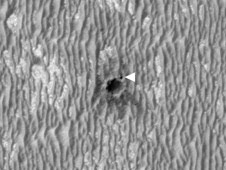
NASA's Mars Odyssey began a second campaign Monday to check on whether the Phoenix Mars Lander has revived itself after the northern Martian winter. The orbiter received no signal from the lander during the first 10 overflights of this campaign.

Odyssey will listen for Phoenix during 50 additional overflights, through Feb. 26, during the current campaign.

Phoenix Mars Lander and surrounding ground as seen from orbit on Feb. 25, 2010

Phoenix landed on Mars on May 25, 2008, and operated successfully in the Martian arctic for about two months longer than its planned three-month mission. Operations ended when waning sunlight left the solar-powered craft with insufficient energy to keep working. The season at the Phoenix landing site is now mid-springtime, with the sun above the horizon for roughly 22 hours each Martian day. That is comparable to the illumination that Phoenix experienced a few weeks after completing its three-month primary mission.

Phoenix was not designed to withstand the extremely low temperatures and the ice load of the Martian arctic winter. In the extremely unlikely event that the lander has survived the winter and has achieved a stable energy state, it would operate in a mode where it periodically awakens and transmits a signal to any orbiter in view.

A third campaign to check on whether Phoenix has revived itself is scheduled for April 5-9, when the sun will be continuously above the Martian horizon at the Phoenix site.

Mars Odyssey is managed for NASA's Science Mission Directorate by the Jet Propulsion Laboratory, a division of the California Institute of Technology in Pasadena. Lockheed Martin Space Systems, Denver, is the prime contractor for the project and made the spacecraft. The successful Phoenix mission was led by Peter Smith of the University of Arizona, Tucson, with project management at JPL and development partnership at Lockheed Martin. International contributions came from the Canadian Space Agency; the University of Neuchatel, Switzerland; the universities of Copenhagen and Aarhus in Denmark; the Max Planck Institute in Germany; the Finnish Meteorological Institute; and Imperial College, London.

Monday, February 22, 2010

Latest Images of space shuttle Endeavour

Headed for the Hangar

Space shuttle Endeavour is prepared for transport to the Orbiter Processing Facility following its successful landing on Runway 15 at the Shuttle Landing Facility at NASA's Kennedy Space Center in Florida.

Homecoming

Darkness enshrouded space shuttle Endeavour as it touched down on Runway 15 at the Shuttle Landing Facility at NASA's Kennedy Space Center in Florida. After 14 days in space, Endeavour's 5.7-million-mile STS-130 mission was completed on orbit 217.

During the STS-130 mission, the crew installed the Tranquility node, a module that provides additional room for crew members and many of the station's life support and environmental control systems. Attached to Tranquility is a cupola that provides a panoramic view of Earth, celestial objects and visiting spacecraft. The module was built in Turin, Italy, by Thales Alenia Space for the European Space Agency. With these improvements, the orbiting laboratory is approximately 90 percent complete.

Behold the Violent History of Saturn's White Whale Moon

Like the battered white whale Moby Dick taunting Captain Ahab, Saturn's moon Prometheus surges toward the viewer in a 3-D image from NASA's Cassini spacecraft.

The image exposes the irregular shape and circular surface scars on Prometheus, pointing to a violent history. These craters are probably the remnants from impacts long ago.

Saturn's potato-shaped moon Prometheus is rendered in three dimensions in this close-up from Cassini.

Saturn's potato-shaped moon
Prometheus is rendered in three dimensions
in this close-up from Cassini.

Prometheus is one of Saturn's innermost moons. It orbits the gas-giant at a distance of about 140,000 kilometers (86,000 miles) and is 86 kilometers (53 miles) across at its widest point. The porous, icy world was originally discovered in images taken by NASA's Voyager 1 spacecraft back in 1980.

Cassini's narrow-angle camera captured two black-and-white images of the moon on Dec. 26, 2009, and the imaging team combined the images to make this new stereo view. It looks different from the "egg-cellent" raw image of Prometheus obtained on Jan. 27 because that view shows one of the short ends of the oddly shaped moon. In this 3-D image, the sun illuminates Prometheus at a different angle, making the moon's elongated body visible.

Wednesday, February 17, 2010

NASA's WISE Mission release First Images

Visitor from Deep Space
Comet Siding Spring appears to streak across the sky like a superhero in this new infrared image from NASA's Wide-field Infrared Survey Explorer, or WISE. The comet, also known as C/2007 Q3, was discovered in 2007 by observers in Australia.


At the Heart of Stellar Chaos This infrared image taken by
NASA's Wide-field Infrared Survey Explorer, or WISE, shows a star-forming cloud teeming with gas, dust and massive newborn stars. The inset reveals the very center of the cloud, a cluster of stars called NGC 3603. It was taken in visible light by NASA's Hubble Space Telescope.


Our Neighbor Andromeda The immense Andromeda galaxy, also known as Messier 31 or simply M31, is captured in full in this new image from NASA's Wide-field Infrared Survey Explorer, or WISE.


Warped Andromeda This image from NASA's Wide-field Infrared Survey Explorer, or WISE, highlights the Andromeda galaxy's older stellar population in blue. It was taken by the shortest-wavelength camera on WISE, which detects infrared light of 3.4 microns.


The Dirt on Andromeda This image from NASA's Wide-field Infrared Survey Explorer, or WISE, highlights the dust that speckles the Andromeda galaxy's spiral arms. It shows light seen by the longest-wavelength infrared detectors on WISE (12-micron light has been color coded orange, and 22-micron light, red).


Fornax Galaxy Cluster This image of a dense cluster of galaxies was captured by NASA's Wide-field Infrared Survey Explorer, or WISE. The cluster, called Fornax because of its location in a constellation of the same name, is 60 million light-years from Earth, and is one of the closest galaxy clusters to the Milky Way.


Ablaze with Infrared Light Is it a bird, or a plane? No, it's comet Siding Spring streaking across the sky, as seen by NASA's Wide-field Infrared Survey Explorer, or WISE. This movie stitches together five frames taken by WISE as it orbited Earth during its ongoing infrared survey of the whole sky. The images span about eight hours of time.

Tuesday, February 16, 2010

Layers Piled in a Mars Crater Record a History of Changes

Near the center of a Martian crater about the size of Connecticut, hundreds of exposed rock layers form a mound as tall as the Rockies and reveal a record of major environmental changes on Mars billions of years ago.

The history told by this tall parfait of layers inside Gale Crater matches what has been proposed in recent years as the dominant planet-wide pattern for early Mars, according to a new report by geologists using instruments on NASA's Mars Reconnaissance Orbiter.

"Looking at the layers from the bottom to the top, from the oldest to the youngest, you see a sequence of changing rocks that resulted from changes in environmental conditions through time," said Ralph Milliken of NASA's Jet Propulsion Laboratory, Pasadena, Calif. "This thick sequence of rocks appears to be showing different steps in the drying-out of Mars."

Using geological layers to understand stages in the evolution of a planet's climate has a precedent on Earth. A change about 1.8 billion years ago in the types of rock layers formed on Earth became a key to understanding a dramatic change in Earth's ancient atmosphere.

Milliken and two co-authors report in Geophysical Research Letters that clay minerals, which form under very wet conditions, are concentrated in layers near the bottom of the Gale stack. Above that, sulfate minerals are intermixed with the clays. Sulfates form in wet conditions and can be deposited when the water in which they are dissolved evaporates. Higher still are sulfate-containing layers without detectable clays. And at the top is a thick formation of regularly spaced layers bearing no detectable water-related minerals.

Monday, February 15, 2010

SDO to Spike important Space Weather Data

Solar storms can wreak havoc on power grids, communications systems and delicate satellites. Currently, there's no way to predict severe space weather, but that could change with the heaps of information NASA's Solar Dynamics Observatory, or SDO, will send back to Earth after its 2010 launch.

"The biggest challenge of this mission was the data rate," said Liz Citrin, SDO project manager at NASA's Goddard Space Flight Center in Greenbelt, Md. "SDO will blast back 1.5 terabytes of information every day . . . that's equivalent to a half-million song downloads. It's unprecedented."

Citrin said there was no way to record that much data on board the spacecraft. Instead, the SDO team designed a mammoth 18-meter radio antenna, as well as a back-up, at White Sands Space Harbor in Las Cruces, N.M., to receive it all. Then, the data will be sent out to scientists at Stanford University in Palo Alto, Calif., the University of Colorado at Boulder, and Lockheed Martin's Solar Astrophysics Lab in Colorado.

The National Oceanic and Atmospheric Administration's Space Weather Prediction Center also is expecting to receive quick-look data the moment SDO is operational.

Another pretty cool technology developed by the SDO team to handle the data rate was the use of the Ka band, which recently was put to use for the Lunar Crater Observation and Sensing Satellite, or LCROSS, mission.

SDO has three major instruments on board that will send data back for at least five years, hopefully 10.

Both the Helioseismic and Magnetic Imager, or HMI, and the Atmospheric Imaging Assembly, or AIA, will allow scientists to see the entire disc of the sun in very high resolution -- 4,096 by 4,096 mm CCDs. In comparison, a standard digital camera uses a 7.176 by 5.329 mm CCD sensor.

AIA also will image the outer layer of the sun's atmosphere, while the Extreme ultraviolet Variability Experiment, or EVE, measures its ultraviolet spectrum every 10 seconds, 24 hours a day.

HMI will map the helioseismic and magnetic fields of the sun to understand its interior and magnetic activity.

"Space weather forecasting is in its infancy. . . just like hurricane forecasting was years ago. We built up experience in collecting data, designed models, tested those models, and now look what we can do," said Citrin. "SDO and all of NASA's Living with a Star Program missions will lead to better prediction of space weather."

SDO will travel to its geosynchronous transfer orbit aboard an Atlas V rocket, a trip that's been much anticipated. The mission was supposed to launch in August 2008, but the spacecraft team needed a few more months of test time.

"Atlas manifest challenges resulted in the current launch date in 2010. The mission team has been very patient and we're all happy to be launching now," said Rex Engelhardt, SDO mission manager.

NASA's Launch Services Program, or LSP, at NASA's Kennedy Space Center, began processing SDO for launch in July 2009.

Engelhardt said from the first day the team had to consider the spacecraft's high-contamination sensitivity.
Inside the Astrotech Space Operations facility in Titusville, Fla., technicians set up a laminar flow enclosure -- a four-wall clean enclose that blows air in one side and sucks it out the other -- keeping the spacecraft free of dust, particles, dirt and debris.

Another unique aspect of this mission is the rocket itself. Unlike other rockets assembled at the launch pad, Atlas rockets are put together in the Vertical Integration Facility on Launch Complex-41 at Cape Canaveral Air Force Station.

"Everything is protected until rollout, which right now is scheduled for Feb. 9," said Engelhardt. "If we needed to roll back, we perform a few disconnects and roll it back. The pad is just a slab of concrete, so after launch there's no tower to refurbish."

Things are looking good for Engelhardt and his LSP team members, who are ready to kick this year off from their home base. Last year they processed and launched eight missions, three from Vandenberg Air Force Base in California.

Friday, February 12, 2010

Shuttle Crew’s First STS-130 Spacewalk Completed


STS-130 crew members installed a 2,600-cubic-foot addition to the International Space Station early Friday, combining the talents of robotic arm operators and spacewalkers to connect the Italian-built Tranquility module.

Tranquility was installed at 1:20 a.m. EST Friday over the Indian Ocean west of Singapore. Mission Specialist Kay Hire and Pilot Terry Virts used the station’s Canadarm2 to pull Tranquility out of the space shuttle Endeavour’s payload bay and position it on the port side of the station’s 10-year-old Unity module. Tranquility was locked in place with 16 remotely controlled bolts.

Spacewalkers Bob Behnken and Nick Patrick stepped outside the Quest airlock module at 9:17 p.m. Thursday and immediately began preparing the new module for its trip from the cargo bay to the station. Mission Specialist Steve Robinson helped coordinate the 6-hour, 32-minute spacewalk, which ended at 3:49 a.m. Friday. As Behnken and Patrick waited for the robotic arm operators to carefully maneuver Tranquility into position, they relocated a temporary platform from the Special Purpose Dexterous Manipulator, or Dextre, to the station’s truss structure and installed two handles on the robot.

Once Tranquility was structurally mated to Unity, the spacewalkers connected heater and data cables that will integrate the new module with the rest of the station’s systems. They also pre-positioned insulation blankets and ammonia hoses that will be used to connect Tranquility to the station’s cooling radiators during the mission’s second spacewalk that begins Saturday night. The station’s new room with a view, the cupola, will be moved from Tranquility’s end to its Earth-facing port on Sunday.

As the spacewalk ended, Mission Control reported that all data and heater connections were working well, and that the vestibule separating Tranquility and Unity had passed its initial leak check.